Sauve geodata
Sauve (Occitanie) is a populated place; located in France in Europe/Paris (GMT+2) time zone. With population of 1,841 people, there are 5145 cities with bigger population in this country. Compared to other cities in France, 87.6% of cities are located further ↑North; 67.3% of cities are located further ←West and 58.3% of cities have higher elevation than Sauve. Note1
Administrative division(s):
- Level 1: Occitanie
- Level 2: Gard
- Level 3: Arrondissement du Vigan
- Level 4: Sauve


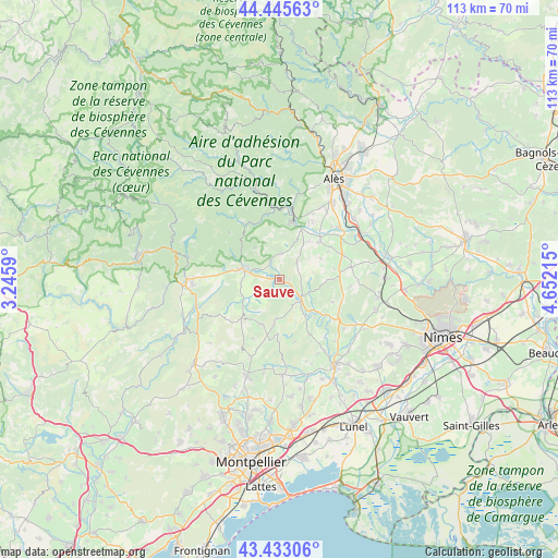
Sauve GPS coordinates[2]
43° 56' 29.4" North, 3° 56' 56.508" East
| Map corner | latitude | longitude |
|---|---|---|
| Upper-left | 44.44563°, | 3.2459° |
| Center: | 43.9415°, | 3.94903° |
| Lower-right: | 43.43306°, | 4.65215° |
| Map W x H: | 112.6×112.6 km | = 70×70mi |
| max Lat: | 51.07786° ⇑87.6% North |
| Sauve: | 43.9415° |
| min Lat: | ⇓12.4% South 41.3874° |
| min Long | Sauve | max Long |
| -5.08615° | 3.94903° | 9.52242° |
| W 67.3%⇐ | ⇒32.7% E |
Elevation
Elevation of Sauve is 107 m = 351 ft, and this is 86.7 m = 284 ft below average elevation for this country.
| Max E: |
2333 m = 7654 ft | 58.3% |
| Avg. | 193.7 m = 635 ft | |
| Sauve | 107 m = 351 ft | |
Min E: |
-1 m = -3 ft | 41.7% |
See also: France elevation on elevation.city.
Geographical zone
Sauve is located in North temperate zone (between Tropic of Cancer and the Arctic Circle). Distance of this Northern Tropic circle is 2279.9 km =1416.7 mi to South.| Distance of | km | miles | from Sauve |
|---|---|---|---|
| North Pole | 5121.2 | 3182.2 | to North |
| Arctic Circle | 2515.3 | 1562.9 | to North |
| Tropic Cancer | 2279.9 | 1416.7 | to South |
| Equator | 4885.8 | 3035.9 | to South |


Nearby cities:
15 places around Sauve: (largest is in red/bold)
• Anduze
12.9 km =8 mi,  13°
13°
• Boisset-et-Gaujac
12.7 km =7.9 mi,  22°
22°
• Cardet
14.1 km =8.8 mi,  48°
48°
• Claret
9.5 km =5.9 mi,  201°
201°
• Corconne
7.8 km =4.8 mi,  185°
185°
• Durfort-et-Saint-Martin-de-Sossenac
5.4 km =3.4 mi, 5°
• Lasalle
13.8 km =8.6 mi,  326°
326°
• Lédignan
13.6 km =8.5 mi,  68°
68°
• Lézan
11.6 km =7.2 mi,  44°
44°
• Massillargues-Attuech
10.1 km =6.3 mi, 36°
• Monoblet
8.2 km =5.1 mi,  323°
323°
• Pompignan
9.2 km =5.7 mi,  234°
234°
• Quissac
5.1 km =3.2 mi,  127°
127°
• Saint-Hippolyte-du-Fort
7.9 km =4.9 mi,  288°
288°
• Tornac
9.7 km =6 mi, 22°
Sources, notices
• [Note1] Compared only with cities in France existing in our database
• [Src1] Map data: © OpenStreetMap contributors (CC-BY-SA)
• [Src2] Other city data from geonames.org with taken over terms of usage.
• [Src3] Geographical zone / Annual Mean Temperature by Robert A. Rohde @ Wikipedia
