Sumène geodata
Sumène (Occitanie) is a populated place; located in France in Europe/Paris (GMT+2) time zone. With population of 1,620 people, there are 5764 cities with bigger population in this country. Compared to other cities in France, 87.2% of cities are located further ↑North; 65.8% of cities are located further ←West and 66.4% of cities have lower elevation than Sumène. Note1
Administrative division(s):
- Level 1: Occitanie
- Level 2: Gard
- Level 3: Arrondissement du Vigan
- Level 4: Sumène


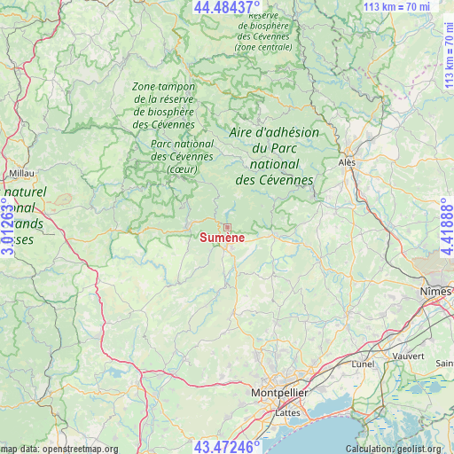
Sumène GPS coordinates[2]
43° 58' 50.052" North, 3° 42' 56.7" East
| Map corner | latitude | longitude |
|---|---|---|
| Upper-left | 44.48437°, | 3.01263° |
| Center: | 43.98057°, | 3.71575° |
| Lower-right: | 43.47246°, | 4.41888° |
| Map W x H: | 112.5×112.5 km | = 69.9×69.9mi |
| max Lat: | 51.07786° ⇑87.2% North |
| Sumène: | 43.98057° |
| min Lat: | ⇓12.8% South 41.3874° |
| min Long | Sumène | max Long |
| -5.08615° | 3.71575° | 9.52242° |
| W 65.8%⇐ | ⇒34.2% E |
Elevation
Elevation of Sumène is 201 m = 659 ft, and this is 7.3 m = 24 ft above average elevation for this country.
| Max E: |
2333 m = 7654 ft | 33.6% |
| Sumène | 201 m 659 ft | |
| Avg. | 193.7 m = 635 ft | |
Min E: |
-1 m = -3 ft | 66.4% |
See also: France elevation on elevation.city.
Geographical zone
Sumène is located in North temperate zone (between Tropic of Cancer and the Arctic Circle). Distance of this Northern Tropic circle is 2284.3 km =1419.4 mi to South.| Distance of | km | miles | from Sumène |
|---|---|---|---|
| North Pole | 5116.9 | 3179.5 | to North |
| Arctic Circle | 2511 | 1560.3 | to North |
| Tropic Cancer | 2284.3 | 1419.4 | to South |
| Equator | 4890.2 | 3038.6 | to South |


Nearby cities:
15 places around Sumène: (largest is in red/bold)
• Avèze
9.2 km =5.7 mi,  263°
263°
• Brissac
11.4 km =7.1 mi,  184°
184°
• Cazilhac
6.8 km =4.2 mi,  188°
188°
• Durfort-et-Saint-Martin-de-Sossenac
19.2 km =11.9 mi,  86°
86°
• Ganges
5.2 km =3.2 mi, 186°
• Laroque
6.4 km =4 mi,  174°
174°
• Lasalle
13.2 km =8.2 mi,  57°
57°
• Le Vigan
8.9 km =5.5 mi,  278°
278°
• Molières-Cavaillac
11.1 km =6.9 mi,  266°
266°
• Monoblet
13.9 km =8.6 mi,  80°
80°
• Pompignan
14.8 km =9.2 mi,  130°
130°
• Saint-André-de-Majencoules
6.2 km =3.9 mi,  328°
328°
• Saint-Bauzille-de-Putois
9.7 km =6 mi, 170°
• Saint-Hippolyte-du-Fort
11.4 km =7.1 mi,  99°
99°
• Valleraugue
12.7 km =7.9 mi, 332°
Sources, notices
• [Note1] Compared only with cities in France existing in our database
• [Src1] Map data: © OpenStreetMap contributors (CC-BY-SA)
• [Src2] Other city data from geonames.org with taken over terms of usage.
• [Src3] Geographical zone / Annual Mean Temperature by Robert A. Rohde @ Wikipedia
