Lasalle geodata
Lasalle (Occitanie) is a populated place; located in France in Europe/Paris (GMT+2) time zone. With population of 1,115 people, there are 8040 cities with bigger population in this country. Compared to other cities in France, 86.7% of cities are located further ↑North; 66.6% of cities are located further ←West and 79.4% of cities have lower elevation than Lasalle. Note1
Administrative division(s):
- Level 1: Occitanie
- Level 2: Gard
- Level 3: Arrondissement du Vigan
- Level 4: Lasalle


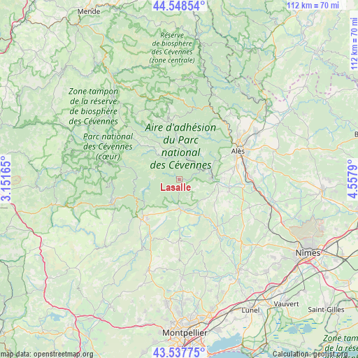
Lasalle GPS coordinates[2]
44° 2' 43.08" North, 3° 51' 17.172" East
| Map corner | latitude | longitude |
|---|---|---|
| Upper-left | 44.54854°, | 3.15165° |
| Center: | 44.0453°, | 3.85477° |
| Lower-right: | 43.53775°, | 4.5579° |
| Map W x H: | 112.4×112.4 km | = 69.8×69.8mi |
| max Lat: | 51.07786° ⇑86.7% North |
| Lasalle: | 44.0453° |
| min Lat: | ⇓13.3% South 41.3874° |
| min Long | Lasalle | max Long |
| -5.08615° | 3.85477° | 9.52242° |
| W 66.6%⇐ | ⇒33.4% E |
Elevation
Elevation of Lasalle is 284 m = 932 ft, and this is 90.3 m = 296 ft above average elevation for this country.
| Max E: |
2333 m = 7654 ft | 20.6% |
| Lasalle | 284 m 932 ft | |
| Avg. | 193.7 m = 635 ft | |
Min E: |
-1 m = -3 ft | 79.4% |
See also: France elevation on elevation.city.
Geographical zone
Lasalle is located in North temperate zone (between Tropic of Cancer and the Arctic Circle). Distance of this Northern Tropic circle is 2291.5 km =1423.9 mi to South.| Distance of | km | miles | from Lasalle |
|---|---|---|---|
| North Pole | 5109.7 | 3175 | to North |
| Arctic Circle | 2503.8 | 1555.8 | to North |
| Tropic Cancer | 2291.5 | 1423.9 | to South |
| Equator | 4897.4 | 3043.1 | to South |


Nearby cities:
15 places around Lasalle: (largest is in red/bold)
• Anduze
10.5 km =6.5 mi,  84°
84°
• Boisset-et-Gaujac
12.3 km =7.6 mi,  88°
88°
• Durfort-et-Saint-Martin-de-Sossenac
10.1 km =6.3 mi,  127°
127°
• Générargues
11.1 km =6.9 mi,  68°
68°
• Lézan
15.9 km =9.9 mi,  101°
101°
• Massillargues-Attuech
14 km =8.7 mi, 103°
• Mialet
10.2 km =6.3 mi,  43°
43°
• Monoblet
5.6 km =3.5 mi,  152°
152°
• Saint-André-de-Majencoules
14.4 km =8.9 mi,  262°
262°
• Saint-Hippolyte-du-Fort
9.1 km =5.7 mi,  179°
179°
• Saint-Jean-du-Gard
7.1 km =4.4 mi,  20°
20°
• Saint-Étienne-Vallée-Française
13.5 km =8.4 mi,  355°
355°
• Sauve
13.8 km =8.6 mi, 146°
• Sumène
13.2 km =8.2 mi,  237°
237°
• Tornac
11.6 km =7.2 mi, 103°
Sources, notices
• [Note1] Compared only with cities in France existing in our database
• [Src1] Map data: © OpenStreetMap contributors (CC-BY-SA)
• [Src2] Other city data from geonames.org with taken over terms of usage.
• [Src3] Geographical zone / Annual Mean Temperature by Robert A. Rohde @ Wikipedia
