Mirepeisset geodata
Mirepeisset (Occitanie) is a populated place; located in France in Europe/Paris (GMT+2) time zone. With population of 745 people, there are 11223 cities with bigger population in this country. Compared to other cities in France, 96% of cities are located further ↑North; 56.4% of cities are located further ←West and 85.9% of cities have higher elevation than Mirepeisset. Note1
Administrative division(s):
- Level 1: Occitanie
- Level 2: Département de l'Aude
- Level 3: Arrondissement de Narbonne
- Level 4: Mirepeisset


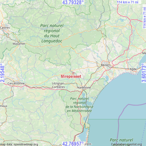
Mirepeisset GPS coordinates[2]
43° 17' 0.888" North, 2° 53' 54.996" East
| Map corner | latitude | longitude |
|---|---|---|
| Upper-left | 43.79328°, | 2.19548° |
| Center: | 43.28358°, | 2.89861° |
| Lower-right: | 42.76957°, | 3.60173° |
| Map W x H: | 113.8×113.8 km | = 70.7×70.7mi |
| max Lat: | 51.07786° ⇑96% North |
| Mirepeisset: | 43.28358° |
| min Lat: | ⇓4% South 41.3874° |
| min Long | Mirepeisset | max Long |
| -5.08615° | 2.89861° | 9.52242° |
| W 56.4%⇐ | ⇒43.6% E |
Elevation
Elevation of Mirepeisset is 40 m = 131 ft, and this is 153.7 m = 504 ft below average elevation for this country.
| Max E: |
2333 m = 7654 ft | 85.9% |
| Avg. | 193.7 m = 635 ft | |
| Mirepeisset | 40 m = 131 ft | |
Min E: |
-1 m = -3 ft | 14.1% |
See also: France elevation on elevation.city.
Geographical zone
Mirepeisset is located in North temperate zone (between Tropic of Cancer and the Arctic Circle). Distance of this Northern Tropic circle is 2206.8 km =1371.2 mi to South.| Distance of | km | miles | from Mirepeisset |
|---|---|---|---|
| North Pole | 5194.4 | 3227.6 | to North |
| Arctic Circle | 2588.5 | 1608.4 | to North |
| Tropic Cancer | 2206.8 | 1371.2 | to South |
| Equator | 4812.7 | 2990.5 | to South |


Nearby cities:
15 places around Mirepeisset: (largest is in red/bold)
• Argeliers
3.3 km =2.1 mi,  16°
16°
• Bize-Minervois
4.3 km =2.7 mi,  328°
328°
• Canet
7.5 km =4.7 mi,  213°
213°
• Cruzy
8.7 km =5.4 mi, 23°
• Ginestas
3 km =1.9 mi,  230°
230°
• Marcorignan
6.7 km =4.2 mi,  162°
162°
• Montredon-des-Corbières
11.5 km =7.1 mi,  165°
165°
• Moussan
7.2 km =4.5 mi,  144°
144°
• Névian
7.9 km =4.9 mi,  177°
177°
• Ouveillan
5.9 km =3.7 mi,  83°
83°
• Quarante
8.7 km =5.4 mi,  36°
36°
• Saint-Marcel-sur-Aude
4.7 km =2.9 mi, 143°
• Saint-Nazaire-d’Aude
4.3 km =2.7 mi, 184°
• Sainte-Valière
4.8 km =3 mi,  255°
255°
• Ventenac-en-Minervois
4.5 km =2.8 mi, 214°
Sources, notices
• [Note1] Compared only with cities in France existing in our database
• [Src1] Map data: © OpenStreetMap contributors (CC-BY-SA)
• [Src2] Other city data from geonames.org with taken over terms of usage.
• [Src3] Geographical zone / Annual Mean Temperature by Robert A. Rohde @ Wikipedia
