Mézilles geodata
Mézilles (Bourgogne-Franche-Comté) is a populated place; located in France in Europe/Paris (GMT+1) time zone. With population of 583 people, there are 13590 cities with bigger population in this country. Compared to other cities in France, 54.3% of cities are located further ↓South; 60.2% of cities are located further ←West and 67.4% of cities have lower elevation than Mézilles. Note1
Administrative division(s):
- Level 1: Bourgogne-Franche-Comté
- Level 2: Département de l'Yonne
- Level 3: Auxerre
- Level 4: Mézilles


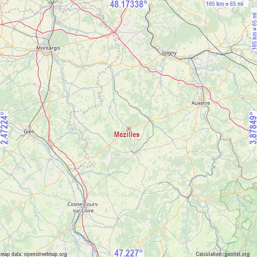
Mézilles GPS coordinates[2]
47° 42' 8.424" North, 3° 10' 31.296" East
| Map corner | latitude | longitude |
|---|---|---|
| Upper-left | 48.17338°, | 2.47224° |
| Center: | 47.70234°, | 3.17536° |
| Lower-right: | 47.227°, | 3.87849° |
| Map W x H: | 105.2×105.2 km | = 65.4×65.4mi |
| max Lat: | 51.07786° ⇑45.7% North |
| Mézilles: | 47.70234° |
| min Lat: | ⇓54.3% South 41.3874° |
| min Long | Mézilles | max Long |
| -5.08615° | 3.17536° | 9.52242° |
| W 60.2%⇐ | ⇒39.8% E |
Elevation
Elevation of Mézilles is 206 m = 676 ft, and this is 12.3 m = 40 ft above average elevation for this country.
| Max E: |
2333 m = 7654 ft | 32.6% |
| Mézilles | 206 m 676 ft | |
| Avg. | 193.7 m = 635 ft | |
Min E: |
-1 m = -3 ft | 67.4% |
See also: France elevation on elevation.city.
Geographical zone
Mézilles is located in North temperate zone (between Tropic of Cancer and the Arctic Circle). Distance of this North polar circle is 2097.2 km =1303.1 mi to North.| Distance of | km | miles | from Mézilles |
|---|---|---|---|
| North Pole | 4703.1 | 2922.4 | to North |
| Arctic Circle | 2097.2 | 1303.1 | to North |
| Tropic Cancer | 2698.1 | 1676.5 | to South |
| Equator | 5304 | 3295.8 | to South |


Nearby cities:
15 places around Mézilles: (largest is in red/bold)
• Bléneau
16.9 km =10.5 mi,  269°
269°
• Champignelles
11.5 km =7.1 mi,  318°
318°
• Charny
21.3 km =13.2 mi,  343°
343°
• Diges
16.9 km =10.5 mi,  80°
80°
• Lindry
21.1 km =13.1 mi,  58°
58°
• Ouanne
18.8 km =11.7 mi,  104°
104°
• Parly
14.6 km =9.1 mi, 61°
• Pourrain
18.7 km =11.6 mi,  71°
71°
• Saint-Amand-en-Puisaye
20.7 km =12.9 mi,  201°
201°
• Saint-Fargeau
10.4 km =6.5 mi,  229°
229°
• Saint-Privé
13.3 km =8.3 mi,  260°
260°
• Saint-Sauveur-en-Puisaye
9.4 km =5.8 mi,  169°
169°
• Saints-en-Puisaye
11.1 km =6.9 mi,  144°
144°
• Toucy
9.7 km =6 mi, 67°
• Treigny
16.9 km =10.5 mi,  177°
177°
Sources, notices
• [Note1] Compared only with cities in France existing in our database
• [Src1] Map data: © OpenStreetMap contributors (CC-BY-SA)
• [Src2] Other city data from geonames.org with taken over terms of usage.
• [Src3] Geographical zone / Annual Mean Temperature by Robert A. Rohde @ Wikipedia
