Pourrain geodata
Pourrain (Bourgogne-Franche-Comté) is a populated place; located in France in Europe/Paris (GMT+2) time zone. With population of 1,363 people, there are 6753 cities with bigger population in this country. Compared to other cities in France, 55.1% of cities are located further ↓South; 63.3% of cities are located further ←West and 76.7% of cities have lower elevation than Pourrain. Note1
Administrative division(s):
- Level 1: Bourgogne-Franche-Comté
- Level 2: Département de l'Yonne
- Level 3: Auxerre
- Level 4: Pourrain


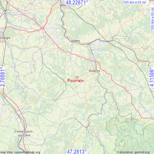
Pourrain GPS coordinates[2]
47° 45' 22.14" North, 3° 24' 42.948" East
| Map corner | latitude | longitude |
|---|---|---|
| Upper-left | 48.22671°, | 2.70881° |
| Center: | 47.75615°, | 3.41193° |
| Lower-right: | 47.2813°, | 4.11506° |
| Map W x H: | 105.1×105.1 km | = 65.3×65.3mi |
| max Lat: | 51.07786° ⇑44.9% North |
| Pourrain: | 47.75615° |
| min Lat: | ⇓55.1% South 41.3874° |
| min Long | Pourrain | max Long |
| -5.08615° | 3.41193° | 9.52242° |
| W 63.3%⇐ | ⇒36.7% E |
Elevation
Elevation of Pourrain is 261 m = 856 ft, and this is 67.3 m = 221 ft above average elevation for this country.
| Max E: |
2333 m = 7654 ft | 23.3% |
| Pourrain | 261 m 856 ft | |
| Avg. | 193.7 m = 635 ft | |
Min E: |
-1 m = -3 ft | 76.7% |
See also: France elevation on elevation.city.
Geographical zone
Pourrain is located in North temperate zone (between Tropic of Cancer and the Arctic Circle). Distance of this North polar circle is 2091.2 km =1299.4 mi to North.| Distance of | km | miles | from Pourrain |
|---|---|---|---|
| North Pole | 4697.1 | 2918.6 | to North |
| Arctic Circle | 2091.2 | 1299.4 | to North |
| Tropic Cancer | 2704.1 | 1680.2 | to South |
| Equator | 5310 | 3299.5 | to South |


Nearby cities:
15 places around Pourrain: (largest is in red/bold)
• Aillant-sur-Tholon
13.9 km =8.6 mi,  340°
340°
• Auxerre
12.8 km =8 mi,  67°
67°
• Charbuy
8.4 km =5.2 mi,  28°
28°
• Coulanges-la-Vineuse
14.1 km =8.8 mi,  115°
115°
• Diges
3.2 km =2 mi,  198°
198°
• Escamps
5.5 km =3.4 mi, 122°
• Fleury-la-Vallée
12.6 km =7.8 mi,  12°
12°
• Lindry
4.9 km =3 mi,  4°
4°
• Ouanne
10.7 km =6.6 mi,  177°
177°
• Parly
4.9 km =3 mi,  281°
281°
• Poilly-sur-Tholon
12.2 km =7.6 mi,  353°
353°
• Saint-Georges-sur-Baulche
10.2 km =6.3 mi,  61°
61°
• Toucy
9 km =5.6 mi,  255°
255°
• Vallan
9.6 km =6 mi,  97°
97°
• Villefargeau
7.3 km =4.5 mi, 68°
Sources, notices
• [Note1] Compared only with cities in France existing in our database
• [Src1] Map data: © OpenStreetMap contributors (CC-BY-SA)
• [Src2] Other city data from geonames.org with taken over terms of usage.
• [Src3] Geographical zone / Annual Mean Temperature by Robert A. Rohde @ Wikipedia
