Treigny geodata
Treigny (Bourgogne-Franche-Comté) is a populated place; located in France in Europe/Paris (GMT+2) time zone. With population of 879 people, there are 9827 cities with bigger population in this country. Compared to other cities in France, 52% of cities are located further ↓South; 60.3% of cities are located further ←West and 72.8% of cities have lower elevation than Treigny. Note1
Administrative division(s):
- Level 1: Bourgogne-Franche-Comté
- Level 2: Département de l'Yonne
- Level 3: Auxerre
- Level 4: Treigny-Perreuse-Sainte-Colombe


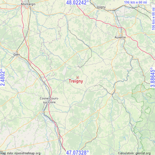
Treigny GPS coordinates[2]
47° 33' 0" North, 3° 10' 59.988" East
| Map corner | latitude | longitude |
|---|---|---|
| Upper-left | 48.02242°, | 2.4802° |
| Center: | 47.55°, | 3.18333° |
| Lower-right: | 47.07328°, | 3.88645° |
| Map W x H: | 105.5×105.5 km | = 65.6×65.6mi |
| max Lat: | 51.07786° ⇑48% North |
| Treigny: | 47.55° |
| min Lat: | ⇓52% South 41.3874° |
| min Long | Treigny | max Long |
| -5.08615° | 3.18333° | 9.52242° |
| W 60.3%⇐ | ⇒39.7% E |
Elevation
Elevation of Treigny is 235 m = 771 ft, and this is 41.3 m = 135 ft above average elevation for this country.
| Max E: |
2333 m = 7654 ft | 27.2% |
| Treigny | 235 m 771 ft | |
| Avg. | 193.7 m = 635 ft | |
Min E: |
-1 m = -3 ft | 72.8% |
See also: France elevation on elevation.city.
Geographical zone
Treigny is located in North temperate zone (between Tropic of Cancer and the Arctic Circle). Distance of this North polar circle is 2114.1 km =1313.6 mi to North.| Distance of | km | miles | from Treigny |
|---|---|---|---|
| North Pole | 4720 | 2932.9 | to North |
| Arctic Circle | 2114.1 | 1313.6 | to North |
| Tropic Cancer | 2681.1 | 1666 | to South |
| Equator | 5287.1 | 3285.3 | to South |


Nearby cities:
15 places around Treigny: (largest is in red/bold)
• Alligny-Cosne
14.1 km =8.8 mi,  220°
220°
• Arquian
14.7 km =9.1 mi,  266°
266°
• Donzy
20.4 km =12.7 mi,  192°
192°
• Entrains-sur-Nohain
11 km =6.8 mi,  149°
149°
• Fontenailles
20.9 km =13 mi,  90°
90°
• La Celle-sur-Loire
21 km =13 mi,  245°
245°
• Myennes
22 km =13.7 mi,  238°
238°
• Mézilles
16.9 km =10.5 mi,  357°
357°
• Ouanne
21.5 km =13.4 mi,  55°
55°
• Saint-Amand-en-Puisaye
8.5 km =5.3 mi, 254°
• Saint-Fargeau
13.2 km =8.2 mi,  320°
320°
• Saint-Privé
20.2 km =12.6 mi, 317°
• Saint-Sauveur-en-Puisaye
7.7 km =4.8 mi,  8°
8°
• Saints-en-Puisaye
9.9 km =6.2 mi,  36°
36°
• Étais-la-Sauvin
13.2 km =8.2 mi,  113°
113°
Sources, notices
• [Note1] Compared only with cities in France existing in our database
• [Src1] Map data: © OpenStreetMap contributors (CC-BY-SA)
• [Src2] Other city data from geonames.org with taken over terms of usage.
• [Src3] Geographical zone / Annual Mean Temperature by Robert A. Rohde @ Wikipedia
