Saint-Amand-en-Puisaye geodata
Saint-Amand-en-Puisaye (Bourgogne-Franche-Comté) is a populated place; located in France in Europe/Paris (GMT+2) time zone. With population of 1,398 people, there are 6613 cities with bigger population in this country. Compared to other cities in France, 51.7% of cities are located further ↓South; 58.9% of cities are located further ←West and 63.6% of cities have lower elevation than Saint-Amand-en-Puisaye. Note1
Administrative division(s):
- Level 1: Bourgogne-Franche-Comté
- Level 2: Département de la Nièvre
- Level 3: Arrondissement de Cosne-Cours-sur-Loire
- Level 4: Saint-Amand-en-Puisaye
Current local time in Saint-Amand-en-Puisaye:
07:23 AM, SaturdayDifference from your time zone: hours


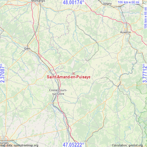
Saint-Amand-en-Puisaye GPS coordinates[2]
47° 31' 44.868" North, 3° 4' 26.4" East
| Map corner | latitude | longitude |
|---|---|---|
| Upper-left | 48.00174°, | 2.37087° |
| Center: | 47.52913°, | 3.074° |
| Lower-right: | 47.05222°, | 3.77712° |
| Map W x H: | 105.6×105.6 km | = 65.6×65.6mi |
| max Lat: | 51.07786° ⇑48.3% North |
| Saint-Amand-en-Puisaye: | 47.52913° |
| min Lat: | ⇓51.7% South 41.3874° |
| min Long | Saint-Amand-en- | max Long |
| -5.08615° | 3.074° | 9.52242° |
| W 58.9%⇐ | ⇒41.1% E |
Elevation
Elevation of Saint-Amand-en-Puisaye is 187 m = 614 ft, and this is 6.7 m = 22 ft below average elevation for this country.
| Max E: |
2333 m = 7654 ft | 36.4% |
| Avg. | 193.7 m = 635 ft | |
| Saint-Amand-en-Puisaye | 187 m = 614 ft | |
Min E: |
-1 m = -3 ft | 63.6% |
See also: France elevation on elevation.city.
Geographical zone
Saint-Amand-en-Puisaye is located in North temperate zone (between Tropic of Cancer and the Arctic Circle). Distance of this North polar circle is 2116.4 km =1315.1 mi to North.| Distance of | km | miles | from Saint-Amand-en-Puisaye |
|---|---|---|---|
| North Pole | 4722.3 | 2934.3 | to North |
| Arctic Circle | 2116.4 | 1315.1 | to North |
| Tropic Cancer | 2678.8 | 1664.5 | to South |
| Equator | 5284.7 | 3283.8 | to South |


Nearby cities:
15 places around Saint-Amand-en-Puisaye: (largest is in red/bold)
• Alligny-Cosne
8.4 km =5.2 mi,  187°
187°
• Arquian
6.6 km =4.1 mi,  282°
282°
• Belleville-sur-Loire
17.1 km =10.6 mi,  259°
259°
• Cosne-Cours-sur-Loire
17.2 km =10.7 mi,  220°
220°
• Donzy
18 km =11.2 mi,  167°
167°
• Entrains-sur-Nohain
15.5 km =9.6 mi,  117°
117°
• La Celle-sur-Loire
12.6 km =7.8 mi,  239°
239°
• Léré
16.7 km =10.4 mi,  246°
246°
• Myennes
14 km =8.7 mi,  228°
228°
• Neuvy-sur-Loire
14.3 km =8.9 mi,  267°
267°
• Saint-Fargeau
12.5 km =7.8 mi,  358°
358°
• Saint-Sauveur-en-Puisaye
13.6 km =8.5 mi,  43°
43°
• Saints-en-Puisaye
17.4 km =10.8 mi,  54°
54°
• Sury-près-Léré
16.3 km =10.1 mi, 252°
• Treigny
8.5 km =5.3 mi,  74°
74°
Sources, notices
• [Note1] Compared only with cities in France existing in our database
• [Src1] Map data: © OpenStreetMap contributors (CC-BY-SA)
• [Src2] Other city data from geonames.org with taken over terms of usage.
• [Src3] Geographical zone / Annual Mean Temperature by Robert A. Rohde @ Wikipedia
