Lignol geodata
Lignol (Brittany) is a populated place; located in France in Europe/Paris (GMT+2) time zone. With population of 926 people, there are 9423 cities with bigger population in this country. Compared to other cities in France, 59.9% of cities are located further ↓South; 97.9% of cities are located further →East and 53.1% of cities have higher elevation than Lignol. Note1
Administrative division(s):
- Level 1: Brittany
- Level 2: Morbihan
- Level 3: Arrondissement de Pontivy
- Level 4: Lignol


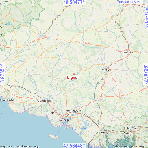
Lignol GPS coordinates[2]
48° 2' 12.372" North, 3° 16' 13.404" West
| Map corner | latitude | longitude |
|---|---|---|
| Upper-left | 48.50477°, | -3.97351° |
| Center: | 48.03677°, | -3.27039° |
| Lower-right: | 47.56448°, | -2.56726° |
| Map W x H: | 104.6×104.5 km | = 65×64.9mi |
| max Lat: | 51.07786° ⇑40.1% North |
| Lignol: | 48.03677° |
| min Lat: | ⇓59.9% South 41.3874° |
| min Long | Lignol | max Long |
| -5.08615° | -3.27039° | 9.52242° |
| W 2.1%⇐ | ⇒97.9% E |
Elevation
Elevation of Lignol is 122 m = 400 ft, and this is 71.7 m = 235 ft below average elevation for this country.
| Max E: |
2333 m = 7654 ft | 53.1% |
| Avg. | 193.7 m = 635 ft | |
| Lignol | 122 m = 400 ft | |
Min E: |
-1 m = -3 ft | 46.9% |
See also: France elevation on elevation.city.
Geographical zone
Lignol is located in North temperate zone (between Tropic of Cancer and the Arctic Circle). Distance of this North polar circle is 2060 km =1280 mi to North.| Distance of | km | miles | from Lignol |
|---|---|---|---|
| North Pole | 4665.9 | 2899.3 | to North |
| Arctic Circle | 2060 | 1280 | to North |
| Tropic Cancer | 2735.3 | 1699.6 | to South |
| Equator | 5341.2 | 3318.9 | to South |


Nearby cities:
15 places around Lignol: (largest is in red/bold)
• Berné
10.3 km =6.4 mi,  243°
243°
• Bieuzy
16.3 km =10.1 mi,  111°
111°
• Bubry
11 km =6.8 mi,  137°
137°
• Guern
13.3 km =8.3 mi,  93°
93°
• Guémené-sur-Scorff
6.2 km =3.9 mi,  57°
57°
• Inguiniel
6.7 km =4.2 mi,  186°
186°
• Lanvaudan
15.3 km =9.5 mi,  177°
177°
• Le Croisty
7.6 km =4.7 mi,  293°
293°
• Melrand
13.5 km =8.4 mi,  117°
117°
• Meslan
12.9 km =8 mi,  248°
248°
• Plouay
14.4 km =8.9 mi,  199°
199°
• Plouray
14.9 km =9.3 mi,  324°
324°
• Ploërdut
5.7 km =3.5 mi,  348°
348°
• Priziac
11.4 km =7.1 mi, 287°
• Séglien
11.4 km =7.1 mi,  46°
46°
Sources, notices
• [Note1] Compared only with cities in France existing in our database
• [Src1] Map data: © OpenStreetMap contributors (CC-BY-SA)
• [Src2] Other city data from geonames.org with taken over terms of usage.
• [Src3] Geographical zone / Annual Mean Temperature by Robert A. Rohde @ Wikipedia
