Langonnet geodata
Langonnet (Brittany) is a populated place; located in France in Europe/Paris (GMT+2) time zone. With population of 2,064 people, there are 4655 cities with bigger population in this country. Compared to other cities in France, 61.3% of cities are located further ↓South; 98.3% of cities are located further →East and 64% of cities have lower elevation than Langonnet. Note1
Administrative division(s):
- Level 1: Brittany
- Level 2: Morbihan
- Level 3: Arrondissement de Pontivy
- Level 4: Langonnet


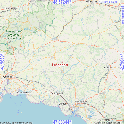
Langonnet GPS coordinates[2]
48° 6' 18.396" North, 3° 29' 36.816" West
| Map corner | latitude | longitude |
|---|---|---|
| Upper-left | 48.57249°, | -4.19669° |
| Center: | 48.10511°, | -3.49356° |
| Lower-right: | 47.63344°, | -2.79044° |
| Map W x H: | 104.4×104.4 km | = 64.9×64.9mi |
| max Lat: | 51.07786° ⇑38.7% North |
| Langonnet: | 48.10511° |
| min Lat: | ⇓61.3% South 41.3874° |
| min Long | Langonnet | max Long |
| -5.08615° | -3.49356° | 9.52242° |
| W 1.7%⇐ | ⇒98.3% E |
Elevation
Elevation of Langonnet is 189 m = 620 ft, and this is 4.7 m = 15 ft below average elevation for this country.
| Max E: |
2333 m = 7654 ft | 36% |
| Avg. | 193.7 m = 635 ft | |
| Langonnet | 189 m = 620 ft | |
Min E: |
-1 m = -3 ft | 64% |
See also: France elevation on elevation.city.
Geographical zone
Langonnet is located in North temperate zone (between Tropic of Cancer and the Arctic Circle). Distance of this North polar circle is 2052.4 km =1275.3 mi to North.| Distance of | km | miles | from Langonnet |
|---|---|---|---|
| North Pole | 4658.3 | 2894.5 | to North |
| Arctic Circle | 2052.4 | 1275.3 | to North |
| Tropic Cancer | 2742.9 | 1704.4 | to South |
| Equator | 5348.8 | 3323.6 | to South |


Nearby cities:
15 places around Langonnet: (largest is in red/bold)
• Berné
14.3 km =8.9 mi,  148°
148°
• Glomel
14.9 km =9.3 mi,  28°
28°
• Gourin
9.2 km =5.7 mi,  293°
293°
• Guiscriff
12.7 km =7.9 mi,  240°
240°
• Lanvénégen
12.4 km =7.7 mi,  196°
196°
• Le Croisty
10.7 km =6.6 mi,  115°
115°
• Le Faouët
8 km =5 mi,  178°
178°
• Le Saint
5.3 km =3.3 mi,  250°
250°
• Meslan
13 km =8.1 mi,  159°
159°
• Motreff
11.6 km =7.2 mi,  337°
337°
• Paule
15 km =9.3 mi,  14°
14°
• Plouray
9.1 km =5.7 mi,  60°
60°
• Ploërdut
15.6 km =9.7 mi,  97°
97°
• Plévin
12.4 km =7.7 mi,  357°
357°
• Priziac
7.1 km =4.4 mi,  126°
126°
Sources, notices
• [Note1] Compared only with cities in France existing in our database
• [Src1] Map data: © OpenStreetMap contributors (CC-BY-SA)
• [Src2] Other city data from geonames.org with taken over terms of usage.
• [Src3] Geographical zone / Annual Mean Temperature by Robert A. Rohde @ Wikipedia
