Mésigny geodata
Mésigny (Auvergne-Rhône-Alpes) is a populated place; located in France in Europe/Paris (GMT+2) time zone. With population of 699 people, there are 11810 cities with bigger population in this country. Compared to other cities in France, 66.4% of cities are located further ↑North; 87.1% of cities are located further ←West and 92.2% of cities have lower elevation than Mésigny. Note1
Administrative division(s):
- Level 1: Auvergne-Rhône-Alpes
- Level 2: Haute-Savoie
- Level 3: Annecy
- Level 4: Mésigny


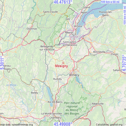
Mésigny GPS coordinates[2]
45° 59' 23.136" North, 6° 0' 15.192" East
| Map corner | latitude | longitude |
|---|---|---|
| Upper-left | 46.47613°, | 5.3011° |
| Center: | 45.98976°, | 6.00422° |
| Lower-right: | 45.49908°, | 6.70735° |
| Map W x H: | 108.6×108.6 km | = 67.5×67.5mi |
| max Lat: | 51.07786° ⇑66.4% North |
| Mésigny: | 45.98976° |
| min Lat: | ⇓33.6% South 41.3874° |
| min Long | Mésigny | max Long |
| -5.08615° | 6.00422° | 9.52242° |
| W 87.1%⇐ | ⇒12.9% E |
Elevation
Elevation of Mésigny is 480 m = 1575 ft, and this is 286.3 m = 939 ft above average elevation for this country.
| Max E: |
2333 m = 7654 ft | 7.8% |
| Mésigny | 480 m 1575 ft | |
| Avg. | 193.7 m = 635 ft | |
Min E: |
-1 m = -3 ft | 92.2% |
See also: France elevation on elevation.city.
Geographical zone
Mésigny is located in North temperate zone (between Tropic of Cancer and the Arctic Circle). Distance of this North polar circle is 2287.6 km =1421.4 mi to North.| Distance of | km | miles | from Mésigny |
|---|---|---|---|
| North Pole | 4893.5 | 3040.7 | to North |
| Arctic Circle | 2287.6 | 1421.4 | to North |
| Tropic Cancer | 2507.7 | 1558.2 | to South |
| Equator | 5113.6 | 3177.4 | to South |


Nearby cities:
15 places around Mésigny: (largest is in red/bold)
• Cercier
5.3 km =3.3 mi,  40°
40°
• Cernex
8.8 km =5.5 mi,  23°
23°
• Chilly
3.8 km =2.4 mi,  273°
273°
• Choisy
4.2 km =2.6 mi,  84°
84°
• Copponex
8.6 km =5.3 mi, 38°
• Frangy
6.5 km =4 mi,  301°
301°
• La Balme-de-Sillingy
3.7 km =2.3 mi,  128°
128°
• Menthonnex-sous-Clermont
6.1 km =3.8 mi,  241°
241°
• Minzier
6.9 km =4.3 mi,  349°
349°
• Nonglard
7.9 km =4.9 mi,  169°
169°
• Sallenôves
1.8 km =1.1 mi,  341°
341°
• Sillingy
5.6 km =3.5 mi,  146°
146°
• Thusy
6.3 km =3.9 mi,  218°
218°
• Vaulx
6.7 km =4.2 mi,  185°
185°
• Épagny
8.5 km =5.3 mi, 134°
Sources, notices
• [Note1] Compared only with cities in France existing in our database
• [Src1] Map data: © OpenStreetMap contributors (CC-BY-SA)
• [Src2] Other city data from geonames.org with taken over terms of usage.
• [Src3] Geographical zone / Annual Mean Temperature by Robert A. Rohde @ Wikipedia
