Saint-Pierre-du-Perray geodata
Saint-Pierre-du-Perray (Île-de-France) is a populated place; located in France in Europe/Paris (GMT+2) time zone. With population of 6,140 people, there are 1613 cities with bigger population in this country. Compared to other cities in France, 71.1% of cities are located further ↓South; 50.5% of cities are located further ←West and 69.2% of cities have higher elevation than Saint-Pierre-du-Perray. Note1
Administrative division(s):
- Level 1: Île-de-France
- Level 2: Département de l'Essonne
- Level 3: Arrondissement d'Évry
- Level 4: Saint-Pierre-du-Perray
Current local time in Saint-Pierre-du-Perray:
01:54 AM, SaturdayDifference from your time zone: hours


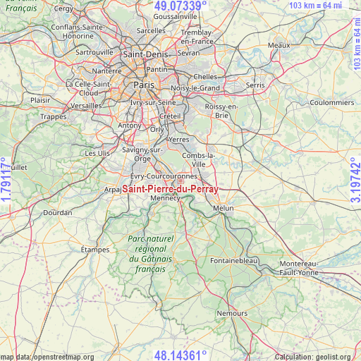
Saint-Pierre-du-Perray GPS coordinates[2]
48° 36' 38.304" North, 2° 29' 39.444" East
| Map corner | latitude | longitude |
|---|---|---|
| Upper-left | 49.07339°, | 1.79117° |
| Center: | 48.61064°, | 2.49429° |
| Lower-right: | 48.14361°, | 3.19742° |
| Map W x H: | 103.4×103.4 km | = 64.2×64.2mi |
| max Lat: | 51.07786° ⇑28.9% North |
| Saint-Pierre-du-Perray: | 48.61064° |
| min Lat: | ⇓71.1% South 41.3874° |
| min Long | Saint-Pierre-du | max Long |
| -5.08615° | 2.49429° | 9.52242° |
| W 50.5%⇐ | ⇒49.5% E |
Elevation
Elevation of Saint-Pierre-du-Perray is 80 m = 262 ft, and this is 113.7 m = 373 ft below average elevation for this country.
| Max E: |
2333 m = 7654 ft | 69.2% |
| Avg. | 193.7 m = 635 ft | |
| Saint-Pierre-du-Perray | 80 m = 262 ft | |
Min E: |
-1 m = -3 ft | 30.8% |
See also: France elevation on elevation.city.
Geographical zone
Saint-Pierre-du-Perray is located in North temperate zone (between Tropic of Cancer and the Arctic Circle). Distance of this North polar circle is 1996.2 km =1240.4 mi to North.| Distance of | km | miles | from Saint-Pierre-du-Perray |
|---|---|---|---|
| North Pole | 4602.1 | 2859.6 | to North |
| Arctic Circle | 1996.2 | 1240.4 | to North |
| Tropic Cancer | 2799.1 | 1739.3 | to South |
| Equator | 5405 | 3358.5 | to South |


Nearby cities:
15 places around Saint-Pierre-du-Perray: (largest is in red/bold)
• Corbeil-Essonnes
0.7 km =0.4 mi,  223°
223°
• Courcouronnes
6.4 km =4 mi,  273°
273°
• Le Coudray-Montceaux
5.2 km =3.2 mi,  175°
175°
• Lieusaint
4.8 km =3 mi,  55°
55°
• Lisses
5.4 km =3.4 mi,  259°
259°
• Mennecy
5.9 km =3.7 mi, 218°
• Nandy
5.9 km =3.7 mi,  121°
121°
• Ormoy
5 km =3.1 mi, 218°
• Saint-Germain-lès-Corbeil
1.4 km =0.9 mi,  339°
339°
• Saintry-sur-Seine
1.6 km =1 mi, 177°
• Soisy-sur-Seine
5.2 km =3.2 mi,  323°
323°
• Tigery
3.7 km =2.3 mi,  15°
15°
• Villabé
4 km =2.5 mi,  233°
233°
• Étiolles
2.6 km =1.6 mi, 339°
• Évry
4.7 km =2.9 mi,  301°
301°
Sources, notices
• [Note1] Compared only with cities in France existing in our database
• [Src1] Map data: © OpenStreetMap contributors (CC-BY-SA)
• [Src2] Other city data from geonames.org with taken over terms of usage.
• [Src3] Geographical zone / Annual Mean Temperature by Robert A. Rohde @ Wikipedia
