Saintry-sur-Seine geodata
Saintry-sur-Seine (Île-de-France) is a populated place; located in France in Europe/Paris (GMT+2) time zone. With population of 5,308 people, there are 1857 cities with bigger population in this country. Compared to other cities in France, 70.8% of cities are located further ↓South; 50.5% of cities are located further ←West and 77.8% of cities have higher elevation than Saintry-sur-Seine. Note1
Administrative division(s):
- Level 1: Île-de-France
- Level 2: Département de l'Essonne
- Level 3: Arrondissement d'Évry
- Level 4: Saintry-sur-Seine


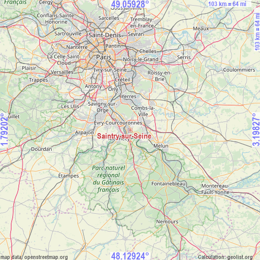
Saintry-sur-Seine GPS coordinates[2]
48° 35' 47.04" North, 2° 29' 42.54" East
| Map corner | latitude | longitude |
|---|---|---|
| Upper-left | 49.05928°, | 1.79202° |
| Center: | 48.5964°, | 2.49515° |
| Lower-right: | 48.12924°, | 3.19827° |
| Map W x H: | 103.4×103.4 km | = 64.2×64.2mi |
| max Lat: | 51.07786° ⇑29.2% North |
| Saintry-sur-Seine: | 48.5964° |
| min Lat: | ⇓70.8% South 41.3874° |
| min Long | Saintry-sur-Sei | max Long |
| -5.08615° | 2.49515° | 9.52242° |
| W 50.5%⇐ | ⇒49.5% E |
Elevation
Elevation of Saintry-sur-Seine is 60 m = 197 ft, and this is 133.7 m = 439 ft below average elevation for this country.
| Max E: |
2333 m = 7654 ft | 77.8% |
| Avg. | 193.7 m = 635 ft | |
| Saintry-sur-Seine | 60 m = 197 ft | |
Min E: |
-1 m = -3 ft | 22.2% |
See also: France elevation on elevation.city.
Geographical zone
Saintry-sur-Seine is located in North temperate zone (between Tropic of Cancer and the Arctic Circle). Distance of this North polar circle is 1997.8 km =1241.4 mi to North.| Distance of | km | miles | from Saintry-sur-Seine |
|---|---|---|---|
| North Pole | 4603.6 | 2860.5 | to North |
| Arctic Circle | 1997.8 | 1241.4 | to North |
| Tropic Cancer | 2797.5 | 1738.3 | to South |
| Equator | 5403.4 | 3357.5 | to South |


Nearby cities:
15 places around Saintry-sur-Seine: (largest is in red/bold)
• Corbeil-Essonnes
1.2 km =0.7 mi,  332°
332°
• Le Coudray-Montceaux
3.6 km =2.2 mi,  174°
174°
• Lieusaint
5.8 km =3.6 mi,  42°
42°
• Lisses
5.4 km =3.4 mi,  276°
276°
• Mennecy
4.8 km =3 mi,  231°
231°
• Nandy
5.2 km =3.2 mi,  106°
106°
• Ormoy
4 km =2.5 mi, 232°
• Saint-Fargeau-Ponthierry
5 km =3.1 mi,  150°
150°
• Saint-Germain-lès-Corbeil
2.9 km =1.8 mi,  349°
349°
• Saint-Pierre-du-Perray
1.6 km =1 mi,  357°
357°
• Seine-Port
6.1 km =3.8 mi,  135°
135°
• Tigery
5.2 km =3.2 mi,  10°
10°
• Villabé
3.3 km =2.1 mi,  256°
256°
• Étiolles
4.1 km =2.5 mi, 346°
• Évry
5.7 km =3.5 mi,  315°
315°
Sources, notices
• [Note1] Compared only with cities in France existing in our database
• [Src1] Map data: © OpenStreetMap contributors (CC-BY-SA)
• [Src2] Other city data from geonames.org with taken over terms of usage.
• [Src3] Geographical zone / Annual Mean Temperature by Robert A. Rohde @ Wikipedia
