Triguères geodata
Triguères (Centre) is a populated place; located in France in Europe/Paris (GMT+2) time zone. With population of 1,210 people, there are 7474 cities with bigger population in this country. Compared to other cities in France, 58.2% of cities are located further ↓South; 57.6% of cities are located further ←West and 53.8% of cities have higher elevation than Triguères. Note1
Administrative division(s):
- Level 1: Centre
- Level 2: Loiret
- Level 3: Arrondissement de Montargis
- Level 4: Triguères


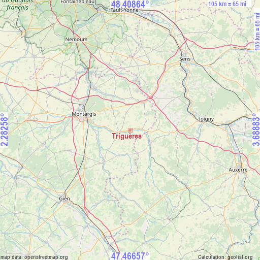
Triguères GPS coordinates[2]
47° 56' 23.1" North, 2° 59' 8.52" East
| Map corner | latitude | longitude |
|---|---|---|
| Upper-left | 48.40864°, | 2.28258° |
| Center: | 47.93975°, | 2.9857° |
| Lower-right: | 47.46657°, | 3.68883° |
| Map W x H: | 104.7×104.7 km | = 65.1×65.1mi |
| max Lat: | 51.07786° ⇑41.8% North |
| Triguères: | 47.93975° |
| min Lat: | ⇓58.2% South 41.3874° |
| min Long | Triguères | max Long |
| -5.08615° | 2.9857° | 9.52242° |
| W 57.6%⇐ | ⇒42.4% E |
Elevation
Elevation of Triguères is 120 m = 394 ft, and this is 73.7 m = 242 ft below average elevation for this country.
| Max E: |
2333 m = 7654 ft | 53.8% |
| Avg. | 193.7 m = 635 ft | |
| Triguères | 120 m = 394 ft | |
Min E: |
-1 m = -3 ft | 46.2% |
See also: France elevation on elevation.city.
Geographical zone
Triguères is located in North temperate zone (between Tropic of Cancer and the Arctic Circle). Distance of this North polar circle is 2070.8 km =1286.7 mi to North.| Distance of | km | miles | from Triguères |
|---|---|---|---|
| North Pole | 4676.7 | 2906 | to North |
| Arctic Circle | 2070.8 | 1286.7 | to North |
| Tropic Cancer | 2724.5 | 1692.9 | to South |
| Equator | 5330.4 | 3312.2 | to South |


Nearby cities:
15 places around Triguères: (largest is in red/bold)
• Charny
10.1 km =6.3 mi,  125°
125°
• Chuelles
7.1 km =4.4 mi,  348°
348°
• Château-Renard
4 km =2.5 mi,  259°
259°
• Courtenay
12.3 km =7.6 mi,  26°
26°
• Douchy
5.1 km =3.2 mi,  86°
86°
• Gy-les-Nonains
10.1 km =6.3 mi,  274°
274°
• La Selle-en-Hermoy
10.4 km =6.5 mi,  319°
319°
• La Selle-sur-le-Bied
15.3 km =9.5 mi,  334°
334°
• Melleroy
5.5 km =3.4 mi,  205°
205°
• Montbouy
15.2 km =9.4 mi,  234°
234°
• Montcresson
13.8 km =8.6 mi,  254°
254°
• Saint-Germain-des-Prés
10.3 km =6.4 mi,  278°
278°
• Saint-Hilaire-les-Andrésis
12.7 km =7.9 mi,  9°
9°
• Saint-Maurice-sur-Aveyron
10.8 km =6.7 mi,  204°
204°
• Villefranche
11 km =6.8 mi, 93°
Sources, notices
• [Note1] Compared only with cities in France existing in our database
• [Src1] Map data: © OpenStreetMap contributors (CC-BY-SA)
• [Src2] Other city data from geonames.org with taken over terms of usage.
• [Src3] Geographical zone / Annual Mean Temperature by Robert A. Rohde @ Wikipedia
