Méjannes-lès-Alès geodata
Méjannes-lès-Alès (Occitanie) is a populated place; located in France in Europe/Paris (GMT+2) time zone. With population of 990 people, there are 8905 cities with bigger population in this country. Compared to other cities in France, 86.2% of cities are located further ↑North; 69.3% of cities are located further ←West and 50.6% of cities have lower elevation than Méjannes-lès-Alès. Note1
Administrative division(s):
- Level 1: Occitanie
- Level 2: Gard
- Level 3: Arrondissement d’Alès
- Level 4: Méjannes-lès-Alès


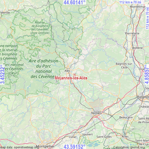
Méjannes-lès-Alès GPS coordinates[2]
44° 5' 55.032" North, 4° 9' 19.62" East
| Map corner | latitude | longitude |
|---|---|---|
| Upper-left | 44.60141°, | 3.45232° |
| Center: | 44.09862°, | 4.15545° |
| Lower-right: | 43.59152°, | 4.85857° |
| Map W x H: | 112.3×112.3 km | = 69.8×69.8mi |
| max Lat: | 51.07786° ⇑86.2% North |
| Méjannes-lès-Alès: | 44.09862° |
| min Lat: | ⇓13.8% South 41.3874° |
| min Long | Méjannes-lès- | max Long |
| -5.08615° | 4.15545° | 9.52242° |
| W 69.3%⇐ | ⇒30.7% E |
Elevation
Elevation of Méjannes-lès-Alès is 134 m = 440 ft, and this is 59.7 m = 196 ft below average elevation for this country.
| Max E: |
2333 m = 7654 ft | 49.4% |
| Avg. | 193.7 m = 635 ft | |
| Méjannes-lès-Alès | 134 m = 440 ft | |
Min E: |
-1 m = -3 ft | 50.6% |
See also: France elevation on elevation.city.
Geographical zone
Méjannes-lès-Alès is located in North temperate zone (between Tropic of Cancer and the Arctic Circle). Distance of this Northern Tropic circle is 2297.4 km =1427.5 mi to South.| Distance of | km | miles | from Méjannes-lès-Alès |
|---|---|---|---|
| North Pole | 5103.8 | 3171.4 | to North |
| Arctic Circle | 2497.9 | 1552.1 | to North |
| Tropic Cancer | 2297.4 | 1427.5 | to South |
| Equator | 4903.3 | 3046.8 | to South |


Nearby cities:
15 places around Méjannes-lès-Alès: (largest is in red/bold)
• Alès
6.6 km =4.1 mi,  296°
296°
• Bagard
8.8 km =5.5 mi,  249°
249°
• Brouzet-lès-Alès
8.3 km =5.2 mi,  59°
59°
• Cendras
9.1 km =5.7 mi,  308°
308°
• Deaux
3.6 km =2.2 mi,  188°
188°
• Mons
2.3 km =1.4 mi,  38°
38°
• Ners
7.9 km =4.9 mi,  176°
176°
• Ribaute-les-Tavernes
9.1 km =5.7 mi,  221°
221°
• Saint-Christol-lès-Alès
6.7 km =4.2 mi, 254°
• Saint-Hilaire-de-Brethmas
3.2 km =2 mi,  229°
229°
• Saint-Julien-les-Rosiers
9.2 km =5.7 mi,  335°
335°
• Saint-Martin-de-Valgalgues
9.2 km =5.7 mi,  321°
321°
• Saint-Privat-des-Vieux
5.5 km =3.4 mi, 338°
• Salindres
8.1 km =5 mi,  2°
2°
• Vézénobres
5.4 km =3.4 mi,  195°
195°
Sources, notices
• [Note1] Compared only with cities in France existing in our database
• [Src1] Map data: © OpenStreetMap contributors (CC-BY-SA)
• [Src2] Other city data from geonames.org with taken over terms of usage.
• [Src3] Geographical zone / Annual Mean Temperature by Robert A. Rohde @ Wikipedia
