Vézénobres geodata
Vézénobres (Occitanie) is a populated place; located in France in Europe/Paris (GMT+2) time zone. With population of 1,619 people, there are 5767 cities with bigger population in this country. Compared to other cities in France, 86.6% of cities are located further ↑North; 69.2% of cities are located further ←West and 55.9% of cities have lower elevation than Vézénobres. Note1
Administrative division(s):
- Level 1: Occitanie
- Level 2: Gard
- Level 3: Arrondissement d’Alès
- Level 4: Vézénobres


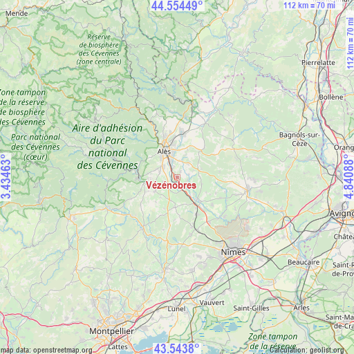
Vézénobres GPS coordinates[2]
44° 3' 4.68" North, 4° 8' 15.9" East
| Map corner | latitude | longitude |
|---|---|---|
| Upper-left | 44.55449°, | 3.43463° |
| Center: | 44.0513°, | 4.13775° |
| Lower-right: | 43.5438°, | 4.84088° |
| Map W x H: | 112.4×112.4 km | = 69.8×69.8mi |
| max Lat: | 51.07786° ⇑86.6% North |
| Vézénobres: | 44.0513° |
| min Lat: | ⇓13.4% South 41.3874° |
| min Long | Vézénobres | max Long |
| -5.08615° | 4.13775° | 9.52242° |
| W 69.2%⇐ | ⇒30.8% E |
Elevation
Elevation of Vézénobres is 153 m = 502 ft, and this is 40.7 m = 134 ft below average elevation for this country.
| Max E: |
2333 m = 7654 ft | 44.1% |
| Avg. | 193.7 m = 635 ft | |
| Vézénobres | 153 m = 502 ft | |
Min E: |
-1 m = -3 ft | 55.9% |
See also: France elevation on elevation.city.
Geographical zone
Vézénobres is located in North temperate zone (between Tropic of Cancer and the Arctic Circle). Distance of this Northern Tropic circle is 2292.1 km =1424.2 mi to South.| Distance of | km | miles | from Vézénobres |
|---|---|---|---|
| North Pole | 5109 | 3174.6 | to North |
| Arctic Circle | 2503.1 | 1555.4 | to North |
| Tropic Cancer | 2292.1 | 1424.2 | to South |
| Equator | 4898 | 3043.5 | to South |


Nearby cities:
15 places around Vézénobres: (largest is in red/bold)
• Bagard
7.2 km =4.5 mi,  287°
287°
• Boucoiran-et-Nozières
7.3 km =4.5 mi,  148°
148°
• Cardet
5.4 km =3.4 mi,  238°
238°
• Cruviers-Lascours
7.5 km =4.7 mi,  136°
136°
• Deaux
2 km =1.2 mi,  27°
27°
• Domessargues
8.8 km =5.5 mi,  164°
164°
• Lédignan
7.6 km =4.7 mi,  199°
199°
• Lézan
8 km =5 mi, 241°
• Mons
7.6 km =4.7 mi,  21°
21°
• Méjannes-lès-Alès
5.4 km =3.4 mi, 15°
• Ners
3.3 km =2.1 mi, 144°
• Ribaute-les-Tavernes
4.8 km =3 mi,  251°
251°
• Saint-Christol-lès-Alès
6.1 km =3.8 mi,  304°
304°
• Saint-Hilaire-de-Brethmas
3.4 km =2.1 mi,  342°
342°
• Saint-Maurice-de-Cazevieille
8 km =5 mi,  107°
107°
Sources, notices
• [Note1] Compared only with cities in France existing in our database
• [Src1] Map data: © OpenStreetMap contributors (CC-BY-SA)
• [Src2] Other city data from geonames.org with taken over terms of usage.
• [Src3] Geographical zone / Annual Mean Temperature by Robert A. Rohde @ Wikipedia
