Marcq-en-Ostrevent geodata
Marcq-en-Ostrevent (Hauts-de-France) is a populated place; located in France in Europe/Paris (GMT+2) time zone. With population of 544 people, there are 14318 cities with bigger population in this country. Compared to other cities in France, 95.4% of cities are located further ↓South; 61.1% of cities are located further ←West and 82.6% of cities have higher elevation than Marcq-en-Ostrevent. Note1
Administrative division(s):
- Level 1: Hauts-de-France
- Level 2: Nord
- Level 3: Arrondissement de Douai
- Level 4: Marcq-en-Ostrevent


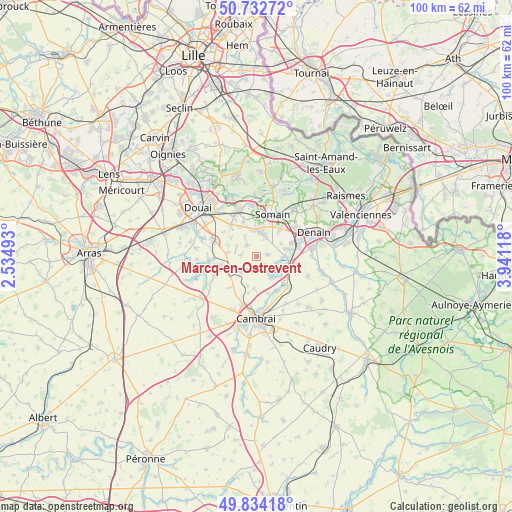
Marcq-en-Ostrevent GPS coordinates[2]
50° 17' 8.052" North, 3° 14' 17.016" East
| Map corner | latitude | longitude |
|---|---|---|
| Upper-left | 50.73272°, | 2.53493° |
| Center: | 50.28557°, | 3.23806° |
| Lower-right: | 49.83418°, | 3.94118° |
| Map W x H: | 99.9×99.9 km | = 62.1×62.1mi |
| max Lat: | 51.07786° ⇑4.6% North |
| Marcq-en-Ostrevent: | 50.28557° |
| min Lat: | ⇓95.4% South 41.3874° |
| min Long | Marcq-en-Ostrev | max Long |
| -5.08615° | 3.23806° | 9.52242° |
| W 61.1%⇐ | ⇒38.9% E |
Elevation
Elevation of Marcq-en-Ostrevent is 48 m = 157 ft, and this is 145.7 m = 478 ft below average elevation for this country.
| Max E: |
2333 m = 7654 ft | 82.6% |
| Avg. | 193.7 m = 635 ft | |
| Marcq-en-Ostrevent | 48 m = 157 ft | |
Min E: |
-1 m = -3 ft | 17.4% |
See also: France elevation on elevation.city.
Geographical zone
Marcq-en-Ostrevent is located in North temperate zone (between Tropic of Cancer and the Arctic Circle). Distance of this North polar circle is 1809.9 km =1124.6 mi to North.| Distance of | km | miles | from Marcq-en-Ostrevent |
|---|---|---|---|
| North Pole | 4415.8 | 2743.9 | to North |
| Arctic Circle | 1809.9 | 1124.6 | to North |
| Tropic Cancer | 2985.3 | 1855 | to South |
| Equator | 5591.2 | 3474.2 | to South |


Nearby cities:
15 places around Marcq-en-Ostrevent: (largest is in red/bold)
• Aniche
5.1 km =3.2 mi,  12°
12°
• Auberchicourt
5.3 km =3.3 mi,  356°
356°
• Aubigny-au-Bac
5.8 km =3.6 mi,  245°
245°
• Bouchain
5.5 km =3.4 mi,  90°
90°
• Fressain
3.1 km =1.9 mi,  273°
273°
• Fressies
4.5 km =2.8 mi,  223°
223°
• Féchain
2.9 km =1.8 mi, 222°
• Hem-Lenglet
3.2 km =2 mi,  192°
192°
• Marquette-en-Ostrevant
2 km =1.2 mi,  96°
96°
• Mastaing
5.3 km =3.3 mi,  64°
64°
• Monchecourt
2.9 km =1.8 mi,  316°
316°
• Paillencourt
5 km =3.1 mi,  149°
149°
• Villers-au-Tertre
4.4 km =2.7 mi,  293°
293°
• Wasnes-au-Bac
2.3 km =1.4 mi,  135°
135°
• Émerchicourt
2.5 km =1.6 mi, 11°
Sources, notices
• [Note1] Compared only with cities in France existing in our database
• [Src1] Map data: © OpenStreetMap contributors (CC-BY-SA)
• [Src2] Other city data from geonames.org with taken over terms of usage.
• [Src3] Geographical zone / Annual Mean Temperature by Robert A. Rohde @ Wikipedia
