Bouchain geodata
Bouchain (Hauts-de-France) is a populated place; located in France in Europe/Paris (GMT+2) time zone. With population of 4,377 people, there are 2252 cities with bigger population in this country. Compared to other cities in France, 95.4% of cities are located further ↓South; 62.2% of cities are located further ←West and 84.5% of cities have higher elevation than Bouchain. Note1
Administrative division(s):
- Level 1: Hauts-de-France
- Level 2: Nord
- Level 3: Arrondissement de Valenciennes
- Level 4: Bouchain


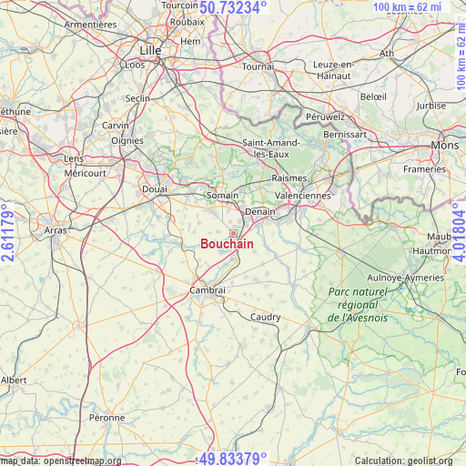
Bouchain GPS coordinates[2]
50° 17' 6.684" North, 3° 18' 53.676" East
| Map corner | latitude | longitude |
|---|---|---|
| Upper-left | 50.73234°, | 2.61179° |
| Center: | 50.28519°, | 3.31491° |
| Lower-right: | 49.83379°, | 4.01804° |
| Map W x H: | 99.9×99.9 km | = 62.1×62.1mi |
| max Lat: | 51.07786° ⇑4.6% North |
| Bouchain: | 50.28519° |
| min Lat: | ⇓95.4% South 41.3874° |
| min Long | Bouchain | max Long |
| -5.08615° | 3.31491° | 9.52242° |
| W 62.2%⇐ | ⇒37.8% E |
Elevation
Elevation of Bouchain is 43 m = 141 ft, and this is 150.7 m = 494 ft below average elevation for this country.
| Max E: |
2333 m = 7654 ft | 84.5% |
| Avg. | 193.7 m = 635 ft | |
| Bouchain | 43 m = 141 ft | |
Min E: |
-1 m = -3 ft | 15.5% |
See also: France elevation on elevation.city.
Geographical zone
Bouchain is located in North temperate zone (between Tropic of Cancer and the Arctic Circle). Distance of this North polar circle is 1810 km =1124.7 mi to North.| Distance of | km | miles | from Bouchain |
|---|---|---|---|
| North Pole | 4415.9 | 2743.9 | to North |
| Arctic Circle | 1810 | 1124.7 | to North |
| Tropic Cancer | 2985.3 | 1855 | to South |
| Equator | 5591.2 | 3474.2 | to South |


Nearby cities:
15 places around Bouchain: (largest is in red/bold)
• Abscon
5.5 km =3.4 mi,  348°
348°
• Douchy-les-Mines
5.8 km =3.6 mi,  72°
72°
• Escaudain
5.7 km =3.5 mi,  21°
21°
• Hordain
2.5 km =1.6 mi,  182°
182°
• Lieu-Saint-Amand
2.6 km =1.6 mi,  120°
120°
• Lourches
4.1 km =2.5 mi,  40°
40°
• Marcq-en-Ostrevent
5.5 km =3.4 mi,  270°
270°
• Marquette-en-Ostrevant
3.4 km =2.1 mi, 266°
• Mastaing
2.4 km =1.5 mi,  342°
342°
• Neuville-sur-Escaut
3 km =1.9 mi,  56°
56°
• Noyelles-sur-Selle
5.1 km =3.2 mi,  89°
89°
• Paillencourt
5.2 km =3.2 mi,  214°
214°
• Rœulx
2.1 km =1.3 mi, 38°
• Wasnes-au-Bac
4.2 km =2.6 mi,  247°
247°
• Émerchicourt
5.5 km =3.4 mi,  297°
297°
Sources, notices
• [Note1] Compared only with cities in France existing in our database
• [Src1] Map data: © OpenStreetMap contributors (CC-BY-SA)
• [Src2] Other city data from geonames.org with taken over terms of usage.
• [Src3] Geographical zone / Annual Mean Temperature by Robert A. Rohde @ Wikipedia
