Marcq geodata
Marcq (Île-de-France) is a populated place; located in France in Europe/Paris (GMT+2) time zone. With population of 631 people, there are 12802 cities with bigger population in this country. Compared to other cities in France, 76.8% of cities are located further ↓South; 59.2% of cities are located further →East and 50.6% of cities have lower elevation than Marcq. Note1
Administrative division(s):
- Level 1: Île-de-France
- Level 2: Yvelines
- Level 3: Arrondissement de Rambouillet
- Level 4: Marcq


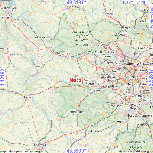
Marcq GPS coordinates[2]
48° 51' 31.104" North, 1° 49' 30.18" East
| Map corner | latitude | longitude |
|---|---|---|
| Upper-left | 49.3191°, | 1.12192° |
| Center: | 48.85864°, | 1.82505° |
| Lower-right: | 48.3939°, | 2.52817° |
| Map W x H: | 102.9×102.9 km | = 63.9×63.9mi |
| max Lat: | 51.07786° ⇑23.2% North |
| Marcq: | 48.85864° |
| min Lat: | ⇓76.8% South 41.3874° |
| min Long | Marcq | max Long |
| -5.08615° | 1.82505° | 9.52242° |
| W 40.8%⇐ | ⇒59.2% E |
Elevation
Elevation of Marcq is 134 m = 440 ft, and this is 59.7 m = 196 ft below average elevation for this country.
| Max E: |
2333 m = 7654 ft | 49.4% |
| Avg. | 193.7 m = 635 ft | |
| Marcq | 134 m = 440 ft | |
Min E: |
-1 m = -3 ft | 50.6% |
See also: France elevation on elevation.city.
Geographical zone
Marcq is located in North temperate zone (between Tropic of Cancer and the Arctic Circle). Distance of this North polar circle is 1968.6 km =1223.2 mi to North.| Distance of | km | miles | from Marcq |
|---|---|---|---|
| North Pole | 4574.5 | 2842.5 | to North |
| Arctic Circle | 1968.6 | 1223.2 | to North |
| Tropic Cancer | 2826.7 | 1756.4 | to South |
| Equator | 5432.6 | 3375.7 | to South |


Nearby cities:
15 places around Marcq: (largest is in red/bold)
• Auteuil
2 km =1.2 mi,  195°
195°
• Beynes
3.5 km =2.2 mi,  94°
94°
• Boissy-sans-Avoir
5 km =3.1 mi, 201°
• Flexanville
6.4 km =4 mi,  264°
264°
• Garancières
6.5 km =4 mi,  232°
232°
• Jumeauville
6.4 km =4 mi,  334°
334°
• Mareil-sur-Mauldre
5.2 km =3.2 mi,  38°
38°
• Maule
6.1 km =3.8 mi,  19°
19°
• Montainville
3.7 km =2.3 mi, 44°
• Neauphle-le-Vieux
5.5 km =3.4 mi,  150°
150°
• Saint-Germain-de-la-Grange
6 km =3.7 mi,  116°
116°
• Saulx-Marchais
2.5 km =1.6 mi,  158°
158°
• Thoiry
2.2 km =1.4 mi,  295°
295°
• Villiers-Saint-Fréderic
6.3 km =3.9 mi,  137°
137°
• Villiers-le-Mahieu
3.9 km =2.4 mi,  273°
273°
Sources, notices
• [Note1] Compared only with cities in France existing in our database
• [Src1] Map data: © OpenStreetMap contributors (CC-BY-SA)
• [Src2] Other city data from geonames.org with taken over terms of usage.
• [Src3] Geographical zone / Annual Mean Temperature by Robert A. Rohde @ Wikipedia
