Neauphle-le-Vieux geodata
Neauphle-le-Vieux (Île-de-France) is a populated place; located in France in Europe/Paris (GMT+1) time zone. With population of 741 people, there are 11277 cities with bigger population in this country. Compared to other cities in France, 75.9% of cities are located further ↓South; 58.7% of cities are located further →East and 69.7% of cities have higher elevation than Neauphle-le-Vieux. Note1
Administrative division(s):
- Level 1: Île-de-France
- Level 2: Yvelines
- Level 3: Arrondissement de Rambouillet
- Level 4: Neauphle-le-Vieux


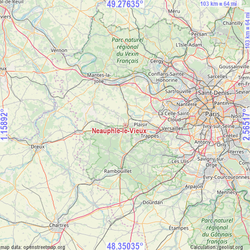
Neauphle-le-Vieux GPS coordinates[2]
48° 48' 55.764" North, 1° 51' 43.344" East
| Map corner | latitude | longitude |
|---|---|---|
| Upper-left | 49.27635°, | 1.15892° |
| Center: | 48.81549°, | 1.86204° |
| Lower-right: | 48.35035°, | 2.56517° |
| Map W x H: | 103×103 km | = 64×64mi |
| max Lat: | 51.07786° ⇑24.1% North |
| Neauphle-le-Vieux: | 48.81549° |
| min Lat: | ⇓75.9% South 41.3874° |
| min Long | Neauphle-le-Vie | max Long |
| -5.08615° | 1.86204° | 9.52242° |
| W 41.3%⇐ | ⇒58.7% E |
Elevation
Elevation of Neauphle-le-Vieux is 79 m = 259 ft, and this is 114.7 m = 376 ft below average elevation for this country.
| Max E: |
2333 m = 7654 ft | 69.7% |
| Avg. | 193.7 m = 635 ft | |
| Neauphle-le-Vieux | 79 m = 259 ft | |
Min E: |
-1 m = -3 ft | 30.3% |
See also: France elevation on elevation.city.
Geographical zone
Neauphle-le-Vieux is located in North temperate zone (between Tropic of Cancer and the Arctic Circle). Distance of this North polar circle is 1973.4 km =1226.2 mi to North.| Distance of | km | miles | from Neauphle-le-Vieux |
|---|---|---|---|
| North Pole | 4579.3 | 2845.4 | to North |
| Arctic Circle | 1973.4 | 1226.2 | to North |
| Tropic Cancer | 2821.9 | 1753.4 | to South |
| Equator | 5427.8 | 3372.7 | to South |


Nearby cities:
15 places around Neauphle-le-Vieux: (largest is in red/bold)
• Auteuil
4.3 km =2.7 mi,  311°
311°
• Bazoches-sur-Guyonne
4.2 km =2.6 mi,  186°
186°
• Beynes
4.6 km =2.9 mi,  9°
9°
• Boissy-sans-Avoir
4.5 km =2.8 mi,  271°
271°
• Galluis
5.4 km =3.4 mi,  247°
247°
• Jouars-Pontchartrain
4 km =2.5 mi,  137°
137°
• Le Tremblay-sur-Mauldre
4.3 km =2.7 mi,  164°
164°
• Les Mesnuls
6.7 km =4.2 mi, 191°
• Marcq
5.5 km =3.4 mi,  330°
330°
• Méré
5 km =3.1 mi,  226°
226°
• Neauphle-le-Château
3.2 km =2 mi,  92°
92°
• Saint-Germain-de-la-Grange
3.4 km =2.1 mi,  52°
52°
• Saulx-Marchais
3.1 km =1.9 mi,  324°
324°
• Thiverval-Grignon
5.5 km =3.4 mi, 46°
• Villiers-Saint-Fréderic
1.6 km =1 mi, 85°
Sources, notices
• [Note1] Compared only with cities in France existing in our database
• [Src1] Map data: © OpenStreetMap contributors (CC-BY-SA)
• [Src2] Other city data from geonames.org with taken over terms of usage.
• [Src3] Geographical zone / Annual Mean Temperature by Robert A. Rohde @ Wikipedia
