Saint-Germain-de-la-Grange geodata
Saint-Germain-de-la-Grange (Île-de-France) is a populated place; located in France in Europe/Paris (GMT+2) time zone. With population of 1,827 people, there are 5188 cities with bigger population in this country. Compared to other cities in France, 76.3% of cities are located further ↓South; 58.3% of cities are located further →East and 57.3% of cities have higher elevation than Saint-Germain-de-la-Grange. Note1
Administrative division(s):
- Level 1: Île-de-France
- Level 2: Yvelines
- Level 3: Arrondissement de Rambouillet
- Level 4: Saint-Germain-de-la-Grange
Current local time in Saint-Germain-de-la-Grange:
12:32 PM, MondayDifference from your time zone: hours


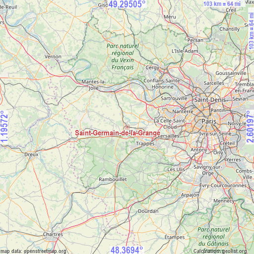
Saint-Germain-de-la-Grange GPS coordinates[2]
48° 50' 3.696" North, 1° 53' 55.824" East
| Map corner | latitude | longitude |
|---|---|---|
| Upper-left | 49.29505°, | 1.19572° |
| Center: | 48.83436°, | 1.89884° |
| Lower-right: | 48.3694°, | 2.60197° |
| Map W x H: | 102.9×102.9 km | = 63.9×63.9mi |
| max Lat: | 51.07786° ⇑23.7% North |
| Saint-Germain-de-la-Grange: | 48.83436° |
| min Lat: | ⇓76.3% South 41.3874° |
| min Long | Saint-Germain-d | max Long |
| -5.08615° | 1.89884° | 9.52242° |
| W 41.7%⇐ | ⇒58.3% E |
Elevation
Elevation of Saint-Germain-de-la-Grange is 110 m = 361 ft, and this is 83.7 m = 275 ft below average elevation for this country.
| Max E: |
2333 m = 7654 ft | 57.3% |
| Avg. | 193.7 m = 635 ft | |
| Saint-Germain-de-la-Grange | 110 m = 361 ft | |
Min E: |
-1 m = -3 ft | 42.7% |
See also: France elevation on elevation.city.
Geographical zone
Saint-Germain-de-la-Grange is located in North temperate zone (between Tropic of Cancer and the Arctic Circle). Distance of this North polar circle is 1971.3 km =1224.9 mi to North.| Distance of | km | miles | from Saint-Germain-de-la-Grange |
|---|---|---|---|
| North Pole | 4577.2 | 2844.1 | to North |
| Arctic Circle | 1971.3 | 1224.9 | to North |
| Tropic Cancer | 2824 | 1754.8 | to South |
| Equator | 5429.9 | 3374 | to South |


Nearby cities:
15 places around Saint-Germain-de-la-Grange: (largest is in red/bold)
• Auteuil
6 km =3.7 mi,  277°
277°
• Beynes
3.1 km =1.9 mi,  321°
321°
• Crespières
5.7 km =3.5 mi,  16°
16°
• Feucherolles
6.8 km =4.2 mi,  54°
54°
• Jouars-Pontchartrain
5.1 km =3.2 mi,  179°
179°
• Le Tremblay-sur-Mauldre
6.4 km =4 mi,  193°
193°
• Les Clayes-sous-Bois
6.6 km =4.1 mi,  101°
101°
• Marcq
6 km =3.7 mi,  296°
296°
• Montainville
6 km =3.7 mi,  332°
332°
• Neauphle-le-Château
2.3 km =1.4 mi,  167°
167°
• Neauphle-le-Vieux
3.4 km =2.1 mi,  232°
232°
• Plaisir
4.2 km =2.6 mi,  107°
107°
• Saulx-Marchais
4.5 km =2.8 mi, 275°
• Thiverval-Grignon
2.2 km =1.4 mi,  38°
38°
• Villiers-Saint-Fréderic
2.3 km =1.4 mi,  209°
209°
Sources, notices
• [Note1] Compared only with cities in France existing in our database
• [Src1] Map data: © OpenStreetMap contributors (CC-BY-SA)
• [Src2] Other city data from geonames.org with taken over terms of usage.
• [Src3] Geographical zone / Annual Mean Temperature by Robert A. Rohde @ Wikipedia
