Olemps geodata
Olemps (Occitanie) is a populated place; located in France in Europe/Paris (GMT+2) time zone. With population of 3,208 people, there are 3038 cities with bigger population in this country. Compared to other cities in France, 84.6% of cities are located further ↑North; 51.4% of cities are located further ←West and 95.2% of cities have lower elevation than Olemps. Note1
Administrative division(s):
- Level 1: Occitanie
- Level 2: Département de l'Aveyron
- Level 3: Arrondissement de Rodez
- Level 4: Olemps


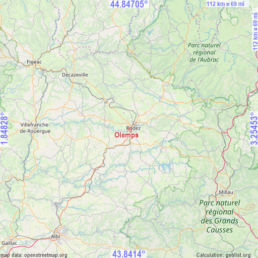
Olemps GPS coordinates[2]
44° 20' 46.968" North, 2° 33' 5.04" East
| Map corner | latitude | longitude |
|---|---|---|
| Upper-left | 44.84705°, | 1.84828° |
| Center: | 44.34638°, | 2.5514° |
| Lower-right: | 43.8414°, | 3.25453° |
| Map W x H: | 111.8×111.8 km | = 69.5×69.5mi |
| max Lat: | 51.07786° ⇑84.6% North |
| Olemps: | 44.34638° |
| min Lat: | ⇓15.4% South 41.3874° |
| min Long | Olemps | max Long |
| -5.08615° | 2.5514° | 9.52242° |
| W 51.4%⇐ | ⇒48.6% E |
Elevation
Elevation of Olemps is 600 m = 1969 ft, and this is 406.3 m = 1333 ft above average elevation for this country.
| Max E: |
2333 m = 7654 ft | 4.8% |
| Olemps | 600 m 1969 ft | |
| Avg. | 193.7 m = 635 ft | |
Min E: |
-1 m = -3 ft | 95.2% |
See also: France elevation on elevation.city.
Geographical zone
Olemps is located in North temperate zone (between Tropic of Cancer and the Arctic Circle). Distance of this Northern Tropic circle is 2324.9 km =1444.6 mi to South.| Distance of | km | miles | from Olemps |
|---|---|---|---|
| North Pole | 5076.2 | 3154.2 | to North |
| Arctic Circle | 2470.3 | 1535 | to North |
| Tropic Cancer | 2324.9 | 1444.6 | to South |
| Equator | 4930.9 | 3063.9 | to South |


Nearby cities:
15 places around Olemps: (largest is in red/bold)
• Balsac
10.6 km =6.6 mi,  306°
306°
• Baraqueville
12.3 km =7.6 mi,  230°
230°
• Calmont
11.3 km =7 mi,  196°
196°
• Druelle
4 km =2.5 mi,  292°
292°
• Flavin
7.7 km =4.8 mi,  146°
146°
• La Loubière
9.7 km =6 mi,  73°
73°
• Le Monastère
2.3 km =1.4 mi,  103°
103°
• Luc-la-Primaube
3.8 km =2.4 mi, 199°
• Manhac
12.2 km =7.6 mi,  212°
212°
• Moyrazès
8.9 km =5.5 mi,  266°
266°
• Rodez
1.9 km =1.2 mi, 68°
• Sainte-Radegonde
6.1 km =3.8 mi, 99°
• Salles-la-Source
10.3 km =6.4 mi,  342°
342°
• Sébazac-Concourès
7.7 km =4.8 mi,  32°
32°
• Trémouilles
13.5 km =8.4 mi, 146°
Sources, notices
• [Note1] Compared only with cities in France existing in our database
• [Src1] Map data: © OpenStreetMap contributors (CC-BY-SA)
• [Src2] Other city data from geonames.org with taken over terms of usage.
• [Src3] Geographical zone / Annual Mean Temperature by Robert A. Rohde @ Wikipedia
