Mane geodata
Mane (Provence-Alpes-Côte d'Azur) is a populated place; located in France in Europe/Paris (GMT+2) time zone. With population of 1,243 people, there are 7314 cities with bigger population in this country. Compared to other cities in France, 87.6% of cities are located further ↑North; 84.8% of cities are located further ←West and 91.2% of cities have lower elevation than Mane. Note1
Administrative division(s):
- Level 1: Provence-Alpes-Côte d'Azur
- Level 2: Alpes-de-Haute-Provence
- Level 3: Arrondissement de Forcalquier
- Level 4: Mane


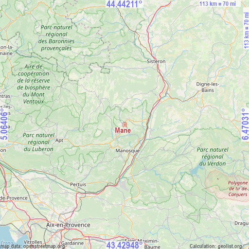
Mane GPS coordinates[2]
43° 56' 16.62" North, 5° 46' 1.848" East
| Map corner | latitude | longitude |
|---|---|---|
| Upper-left | 44.44211°, | 5.06406° |
| Center: | 43.93795°, | 5.76718° |
| Lower-right: | 43.42948°, | 6.47031° |
| Map W x H: | 112.6×112.6 km | = 70×70mi |
| max Lat: | 51.07786° ⇑87.6% North |
| Mane: | 43.93795° |
| min Lat: | ⇓12.4% South 41.3874° |
| min Long | Mane | max Long |
| -5.08615° | 5.76718° | 9.52242° |
| W 84.8%⇐ | ⇒15.2% E |
Elevation
Elevation of Mane is 454 m = 1490 ft, and this is 260.3 m = 854 ft above average elevation for this country.
| Max E: |
2333 m = 7654 ft | 8.8% |
| Mane | 454 m 1490 ft | |
| Avg. | 193.7 m = 635 ft | |
Min E: |
-1 m = -3 ft | 91.2% |
See also: France elevation on elevation.city.
Geographical zone
Mane is located in North temperate zone (between Tropic of Cancer and the Arctic Circle). Distance of this Northern Tropic circle is 2279.5 km =1416.4 mi to South.| Distance of | km | miles | from Mane |
|---|---|---|---|
| North Pole | 5121.6 | 3182.4 | to North |
| Arctic Circle | 2515.7 | 1563.2 | to North |
| Tropic Cancer | 2279.5 | 1416.4 | to South |
| Equator | 4885.4 | 3035.6 | to South |


Nearby cities:
15 places around Mane: (largest is in red/bold)
• Banon
15.7 km =9.8 mi,  314°
314°
• Cruis
14.9 km =9.3 mi,  21°
21°
• Dauphin
4.6 km =2.9 mi,  164°
164°
• Forcalquier
2.6 km =1.6 mi, 22°
• La Brillanne
10 km =6.2 mi,  96°
96°
• Manosque
12.2 km =7.6 mi,  172°
172°
• Oraison
12.3 km =7.6 mi, 100°
• Pierrerue
5.6 km =3.5 mi,  69°
69°
• Pierrevert
14.1 km =8.8 mi,  185°
185°
• Reillanne
10.9 km =6.8 mi,  232°
232°
• Saint-Maime
4.3 km =2.7 mi,  151°
151°
• Saint-Michel-l’Observatoire
5.2 km =3.2 mi, 232°
• Saint-Étienne-les-Orgues
12 km =7.5 mi,  4°
4°
• Villeneuve
9.1 km =5.7 mi,  122°
122°
• Volx
8.9 km =5.5 mi,  138°
138°
Sources, notices
• [Note1] Compared only with cities in France existing in our database
• [Src1] Map data: © OpenStreetMap contributors (CC-BY-SA)
• [Src2] Other city data from geonames.org with taken over terms of usage.
• [Src3] Geographical zone / Annual Mean Temperature by Robert A. Rohde @ Wikipedia
