Maligny geodata
Maligny (Bourgogne-Franche-Comté) is a populated place; located in France in Europe/Paris (GMT+2) time zone. With population of 725 people, there are 11465 cities with bigger population in this country. Compared to other cities in France, 57% of cities are located further ↓South; 66.1% of cities are located further ←West and 50.3% of cities have lower elevation than Maligny. Note1
Administrative division(s):
- Level 1: Bourgogne-Franche-Comté
- Level 2: Département de l'Yonne
- Level 3: Auxerre
- Level 4: Maligny


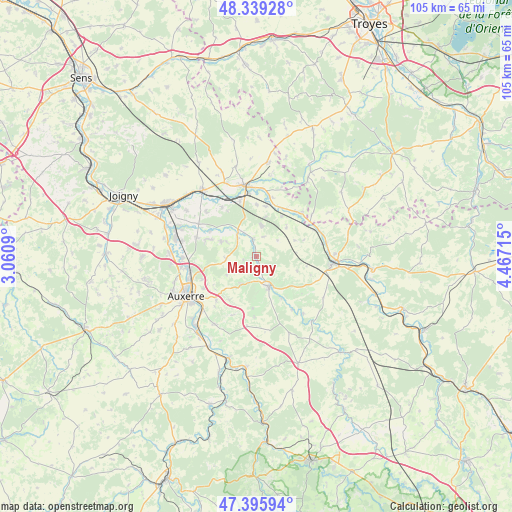
Maligny GPS coordinates[2]
47° 52' 11.136" North, 3° 45' 50.508" East
| Map corner | latitude | longitude |
|---|---|---|
| Upper-left | 48.33928°, | 3.0609° |
| Center: | 47.86976°, | 3.76403° |
| Lower-right: | 47.39594°, | 4.46715° |
| Map W x H: | 104.9×104.9 km | = 65.2×65.2mi |
| max Lat: | 51.07786° ⇑43% North |
| Maligny: | 47.86976° |
| min Lat: | ⇓57% South 41.3874° |
| min Long | Maligny | max Long |
| -5.08615° | 3.76403° | 9.52242° |
| W 66.1%⇐ | ⇒33.9% E |
Elevation
Elevation of Maligny is 133 m = 436 ft, and this is 60.7 m = 199 ft below average elevation for this country.
| Max E: |
2333 m = 7654 ft | 49.7% |
| Avg. | 193.7 m = 635 ft | |
| Maligny | 133 m = 436 ft | |
Min E: |
-1 m = -3 ft | 50.3% |
See also: France elevation on elevation.city.
Geographical zone
Maligny is located in North temperate zone (between Tropic of Cancer and the Arctic Circle). Distance of this North polar circle is 2078.6 km =1291.6 mi to North.| Distance of | km | miles | from Maligny |
|---|---|---|---|
| North Pole | 4684.4 | 2910.8 | to North |
| Arctic Circle | 2078.6 | 1291.6 | to North |
| Tropic Cancer | 2716.7 | 1688.1 | to South |
| Equator | 5322.6 | 3307.3 | to South |


Nearby cities:
15 places around Maligny: (largest is in red/bold)
• Chablis
6.7 km =4.2 mi,  157°
157°
• Chemilly-sur-Yonne
15.4 km =9.6 mi,  281°
281°
• Flogny-la-Chapelle
11.8 km =7.3 mi,  40°
40°
• Germigny
14 km =8.7 mi,  5°
5°
• Gurgy
15 km =9.3 mi,  268°
268°
• Héry
10.7 km =6.6 mi,  289°
289°
• Ligny-le-Châtel
3.4 km =2.1 mi,  351°
351°
• Mont-Saint-Sulpice
13.9 km =8.6 mi,  312°
312°
• Montigny-la-Resle
6.3 km =3.9 mi, 265°
• Monéteau
13.8 km =8.6 mi,  260°
260°
• Pontigny
5.5 km =3.4 mi,  315°
315°
• Saint-Florentin
14.8 km =9.2 mi, 348°
• Seignelay
12.8 km =8 mi, 288°
• Venoy
11.9 km =7.4 mi,  232°
232°
• Vergigny
11.7 km =7.3 mi,  343°
343°
Sources, notices
• [Note1] Compared only with cities in France existing in our database
• [Src1] Map data: © OpenStreetMap contributors (CC-BY-SA)
• [Src2] Other city data from geonames.org with taken over terms of usage.
• [Src3] Geographical zone / Annual Mean Temperature by Robert A. Rohde @ Wikipedia
