Ligny-le-Châtel geodata
Ligny-le-Châtel (Bourgogne-Franche-Comté) is a populated place; located in France in Europe/Paris (GMT+2) time zone. With population of 1,339 people, there are 6866 cities with bigger population in this country. Compared to other cities in France, 57.6% of cities are located further ↓South; 66.1% of cities are located further ←West and 52% of cities have higher elevation than Ligny-le-Châtel. Note1
Administrative division(s):
- Level 1: Bourgogne-Franche-Comté
- Level 2: Département de l'Yonne
- Level 3: Auxerre
- Level 4: Ligny-le-Châtel


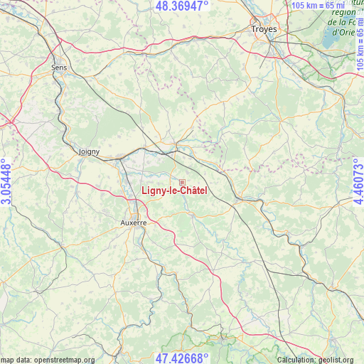
Ligny-le-Châtel GPS coordinates[2]
47° 54' 0.792" North, 3° 45' 27.36" East
| Map corner | latitude | longitude |
|---|---|---|
| Upper-left | 48.36947°, | 3.05448° |
| Center: | 47.90022°, | 3.7576° |
| Lower-right: | 47.42668°, | 4.46073° |
| Map W x H: | 104.8×104.8 km | = 65.1×65.1mi |
| max Lat: | 51.07786° ⇑42.4% North |
| Ligny-le-Châtel: | 47.90022° |
| min Lat: | ⇓57.6% South 41.3874° |
| min Long | Ligny-le-Châte | max Long |
| -5.08615° | 3.7576° | 9.52242° |
| W 66.1%⇐ | ⇒33.9% E |
Elevation
Elevation of Ligny-le-Châtel is 125 m = 410 ft, and this is 68.7 m = 225 ft below average elevation for this country.
| Max E: |
2333 m = 7654 ft | 52% |
| Avg. | 193.7 m = 635 ft | |
| Ligny-le-Châtel | 125 m = 410 ft | |
Min E: |
-1 m = -3 ft | 48% |
See also: France elevation on elevation.city.
Geographical zone
Ligny-le-Châtel is located in North temperate zone (between Tropic of Cancer and the Arctic Circle). Distance of this North polar circle is 2075.2 km =1289.5 mi to North.| Distance of | km | miles | from Ligny-le-Châtel |
|---|---|---|---|
| North Pole | 4681.1 | 2908.7 | to North |
| Arctic Circle | 2075.2 | 1289.5 | to North |
| Tropic Cancer | 2720.1 | 1690.2 | to South |
| Equator | 5326 | 3309.4 | to South |


Nearby cities:
15 places around Ligny-le-Châtel: (largest is in red/bold)
• Brienon-sur-Armançon
14.5 km =9 mi,  313°
313°
• Chablis
10.1 km =6.3 mi,  162°
162°
• Chemilly-sur-Yonne
14.6 km =9.1 mi,  269°
269°
• Flogny-la-Chapelle
9.8 km =6.1 mi,  55°
55°
• Germigny
10.7 km =6.6 mi,  9°
9°
• Héry
9.6 km =6 mi, 270°
• Maligny
3.4 km =2.1 mi,  171°
171°
• Mont-Saint-Sulpice
11.4 km =7.1 mi,  301°
301°
• Montigny-la-Resle
6.9 km =4.3 mi,  236°
236°
• Monéteau
14.3 km =8.9 mi,  246°
246°
• Pontigny
3.4 km =2.1 mi,  279°
279°
• Saint-Florentin
11.4 km =7.1 mi,  347°
347°
• Seignelay
11.7 km =7.3 mi, 272°
• Venoy
13.9 km =8.6 mi,  220°
220°
• Vergigny
8.3 km =5.2 mi,  339°
339°
Sources, notices
• [Note1] Compared only with cities in France existing in our database
• [Src1] Map data: © OpenStreetMap contributors (CC-BY-SA)
• [Src2] Other city data from geonames.org with taken over terms of usage.
• [Src3] Geographical zone / Annual Mean Temperature by Robert A. Rohde @ Wikipedia
