Fleury-sur-Andelle geodata
Fleury-sur-Andelle (Normandy) is a populated place; located in France in Europe/Paris (GMT+2) time zone. With population of 1,995 people, there are 4802 cities with bigger population in this country. Compared to other cities in France, 87.2% of cities are located further ↓South; 64.9% of cities are located further →East and 89.1% of cities have higher elevation than Fleury-sur-Andelle. Note1
Administrative division(s):
- Level 1: Normandy
- Level 2: Département de l'Eure
- Level 3: Les Andelys
- Level 4: Fleury-sur-Andelle


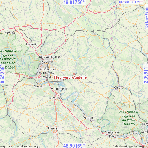
Fleury-sur-Andelle GPS coordinates[2]
49° 21' 42.336" North, 1° 21' 21.564" East
| Map corner | latitude | longitude |
|---|---|---|
| Upper-left | 49.81756°, | 0.65286° |
| Center: | 49.36176°, | 1.35599° |
| Lower-right: | 48.90169°, | 2.05911° |
| Map W x H: | 101.8×101.8 km | = 63.3×63.3mi |
| max Lat: | 51.07786° ⇑12.8% North |
| Fleury-sur-Andelle: | 49.36176° |
| min Lat: | ⇓87.2% South 41.3874° |
| min Long | Fleury-sur-Ande | max Long |
| -5.08615° | 1.35599° | 9.52242° |
| W 35.1%⇐ | ⇒64.9% E |
Elevation
Elevation of Fleury-sur-Andelle is 32 m = 105 ft, and this is 161.7 m = 531 ft below average elevation for this country.
| Max E: |
2333 m = 7654 ft | 89.1% |
| Avg. | 193.7 m = 635 ft | |
| Fleury-sur-Andelle | 32 m = 105 ft | |
Min E: |
-1 m = -3 ft | 10.9% |
See also: France elevation on elevation.city.
Geographical zone
Fleury-sur-Andelle is located in North temperate zone (between Tropic of Cancer and the Arctic Circle). Distance of this North polar circle is 1912.7 km =1188.5 mi to North.| Distance of | km | miles | from Fleury-sur-Andelle |
|---|---|---|---|
| North Pole | 4518.5 | 2807.7 | to North |
| Arctic Circle | 1912.7 | 1188.5 | to North |
| Tropic Cancer | 2882.6 | 1791.2 | to South |
| Equator | 5488.5 | 3410.4 | to South |


Nearby cities:
15 places around Fleury-sur-Andelle: (largest is in red/bold)
• Auzouville-sur-Ry
9.5 km =5.9 mi,  339°
339°
• Bourg-Beaudouin
4.4 km =2.7 mi,  309°
309°
• Charleval
2.4 km =1.5 mi,  58°
58°
• Fresne-le-Plan
7.1 km =4.4 mi,  321°
321°
• Grainville
1.8 km =1.1 mi,  153°
153°
• Les Hogues
7.7 km =4.8 mi,  22°
22°
• Lyons-la-Forêt
9.7 km =6 mi, 64°
• Mesnil-Raoul
7 km =4.3 mi,  303°
303°
• Montmain
10.1 km =6.3 mi, 301°
• Perriers-sur-Andelle
6 km =3.7 mi,  10°
10°
• Pont-Saint-Pierre
6.5 km =4 mi,  243°
243°
• Radepont
2.3 km =1.4 mi, 240°
• Romilly-sur-Andelle
7.6 km =4.7 mi, 244°
• Vandrimare
2.2 km =1.4 mi,  334°
334°
• Écouis
7.9 km =4.9 mi,  135°
135°
Sources, notices
• [Note1] Compared only with cities in France existing in our database
• [Src1] Map data: © OpenStreetMap contributors (CC-BY-SA)
• [Src2] Other city data from geonames.org with taken over terms of usage.
• [Src3] Geographical zone / Annual Mean Temperature by Robert A. Rohde @ Wikipedia
