Lunery geodata
Lunery (Centre) is a populated place; located in France in Europe/Paris (GMT+2) time zone. With population of 1,546 people, there are 6028 cities with bigger population in this country. Compared to other cities in France, 56% of cities are located further ↑North; 53.2% of cities are located further →East and 50.2% of cities have higher elevation than Lunery. Note1
Administrative division(s):
- Level 1: Centre
- Level 2: Cher
- Level 3: Arrondissement de Bourges
- Level 4: Lunery


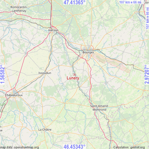
Lunery GPS coordinates[2]
46° 56' 8.484" North, 2° 16' 8.22" East
| Map corner | latitude | longitude |
|---|---|---|
| Upper-left | 47.41365°, | 1.56582° |
| Center: | 46.93569°, | 2.26895° |
| Lower-right: | 46.45343°, | 2.97207° |
| Map W x H: | 106.8×106.8 km | = 66.4×66.4mi |
| max Lat: | 51.07786° ⇑56% North |
| Lunery: | 46.93569° |
| min Lat: | ⇓44% South 41.3874° |
| min Long | Lunery | max Long |
| -5.08615° | 2.26895° | 9.52242° |
| W 46.8%⇐ | ⇒53.2% E |
Elevation
Elevation of Lunery is 131 m = 430 ft, and this is 62.7 m = 206 ft below average elevation for this country.
| Max E: |
2333 m = 7654 ft | 50.2% |
| Avg. | 193.7 m = 635 ft | |
| Lunery | 131 m = 430 ft | |
Min E: |
-1 m = -3 ft | 49.8% |
See also: France elevation on elevation.city.
Geographical zone
Lunery is located in North temperate zone (between Tropic of Cancer and the Arctic Circle). Distance of this North polar circle is 2182.4 km =1356.1 mi to North.| Distance of | km | miles | from Lunery |
|---|---|---|---|
| North Pole | 4788.3 | 2975.3 | to North |
| Arctic Circle | 2182.4 | 1356.1 | to North |
| Tropic Cancer | 2612.8 | 1623.5 | to South |
| Equator | 5218.8 | 3242.8 | to South |


Nearby cities:
15 places around Lunery: (largest is in red/bold)
• Chezal-Benoît
17.1 km =10.6 mi,  223°
223°
• Chârost
13.3 km =8.3 mi,  299°
299°
• Châteauneuf-sur-Cher
9.4 km =5.8 mi,  157°
157°
• Civray
8 km =5 mi, 295°
• La Chapelle-Saint-Ursin
14.7 km =9.1 mi,  16°
16°
• Le Subdray
8.7 km =5.4 mi,  12°
12°
• Levet
10.6 km =6.6 mi,  95°
95°
• Mareuil-sur-Arnon
10.3 km =6.4 mi,  233°
233°
• Marmagne
18.3 km =11.4 mi,  3°
3°
• Morthomiers
11.3 km =7 mi, 2°
• Plaimpied-Givaudins
15.7 km =9.8 mi,  63°
63°
• Saint-Florent-sur-Cher
6.8 km =4.2 mi,  348°
348°
• Saint-Germain-des-Bois
13.6 km =8.5 mi, 100°
• Trouy
10.9 km =6.8 mi,  39°
39°
• Venesmes
11.2 km =7 mi, 162°
Sources, notices
• [Note1] Compared only with cities in France existing in our database
• [Src1] Map data: © OpenStreetMap contributors (CC-BY-SA)
• [Src2] Other city data from geonames.org with taken over terms of usage.
• [Src3] Geographical zone / Annual Mean Temperature by Robert A. Rohde @ Wikipedia
