La Chapelle-Saint-Ursin geodata
La Chapelle-Saint-Ursin (Centre) is a populated place; located in France in Europe/Paris (GMT+2) time zone. With population of 3,245 people, there are 3010 cities with bigger population in this country. Compared to other cities in France, 54.6% of cities are located further ↑North; 52.3% of cities are located further →East and 54.7% of cities have lower elevation than La Chapelle-Saint-Ursin. Note1
Administrative division(s):
- Level 1: Centre
- Level 2: Cher
- Level 3: Arrondissement de Bourges
- Level 4: La Chapelle-Saint-Ursin
Current local time in La Chapelle-Saint-Ursin:
02:20 AM, SaturdayDifference from your time zone: hours


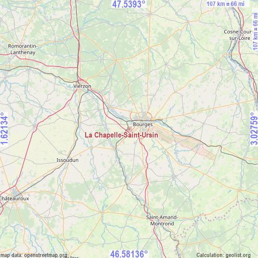
La Chapelle-Saint-Ursin GPS coordinates[2]
47° 3' 44.928" North, 2° 19' 28.092" East
| Map corner | latitude | longitude |
|---|---|---|
| Upper-left | 47.5393°, | 1.62134° |
| Center: | 47.06248°, | 2.32447° |
| Lower-right: | 46.58136°, | 3.02759° |
| Map W x H: | 106.5×106.5 km | = 66.2×66.2mi |
| max Lat: | 51.07786° ⇑54.6% North |
| La Chapelle-Saint-Ursin: | 47.06248° |
| min Lat: | ⇓45.4% South 41.3874° |
| min Long | La Chapelle-Sai | max Long |
| -5.08615° | 2.32447° | 9.52242° |
| W 47.7%⇐ | ⇒52.3% E |
Elevation
Elevation of La Chapelle-Saint-Ursin is 149 m = 489 ft, and this is 44.7 m = 147 ft below average elevation for this country.
| Max E: |
2333 m = 7654 ft | 45.3% |
| Avg. | 193.7 m = 635 ft | |
| La Chapelle-Saint-Ursin | 149 m = 489 ft | |
Min E: |
-1 m = -3 ft | 54.7% |
See also: France elevation on elevation.city.
Geographical zone
La Chapelle-Saint-Ursin is located in North temperate zone (between Tropic of Cancer and the Arctic Circle). Distance of this North polar circle is 2168.3 km =1347.3 mi to North.| Distance of | km | miles | from La Chapelle-Saint-Ursin |
|---|---|---|---|
| North Pole | 4774.2 | 2966.5 | to North |
| Arctic Circle | 2168.3 | 1347.3 | to North |
| Tropic Cancer | 2626.9 | 1632.3 | to South |
| Equator | 5232.9 | 3251.6 | to South |


Nearby cities:
15 places around La Chapelle-Saint-Ursin: (largest is in red/bold)
• Berry-Bouy
5.9 km =3.7 mi,  332°
332°
• Bourges
6.2 km =3.9 mi,  67°
67°
• Fussy
12 km =7.5 mi,  41°
41°
• Le Subdray
6 km =3.7 mi,  201°
201°
• Marmagne
5.2 km =3.2 mi,  323°
323°
• Mehun-sur-Yèvre
12 km =7.5 mi,  314°
314°
• Morthomiers
4.7 km =2.9 mi,  233°
233°
• Plaimpied-Givaudins
12.2 km =7.6 mi,  126°
126°
• Saint-Doulchard
5 km =3.1 mi,  24°
24°
• Saint-Florent-sur-Cher
9.3 km =5.8 mi,  216°
216°
• Saint-Germain-du-Puy
12.7 km =7.9 mi, 70°
• Saint-Éloy-de-Gy
10.4 km =6.5 mi,  7°
7°
• Soye-en-Septaine
13 km =8.1 mi,  107°
107°
• Trouy
6.3 km =3.9 mi,  154°
154°
• Vasselay
11.6 km =7.2 mi,  25°
25°
Sources, notices
• [Note1] Compared only with cities in France existing in our database
• [Src1] Map data: © OpenStreetMap contributors (CC-BY-SA)
• [Src2] Other city data from geonames.org with taken over terms of usage.
• [Src3] Geographical zone / Annual Mean Temperature by Robert A. Rohde @ Wikipedia
