Chezal-Benoît geodata
Chezal-Benoît (Centre) is a populated place; located in France in Europe/Paris (GMT+2) time zone. With population of 970 people, there are 9062 cities with bigger population in this country. Compared to other cities in France, 57% of cities are located further ↑North; 55.7% of cities are located further →East and 61.9% of cities have lower elevation than Chezal-Benoît. Note1
Administrative division(s):
- Level 1: Centre
- Level 2: Cher
- Level 3: Arrondissement de Saint-Amand-Montrond
- Level 4: Chezal-Benoît


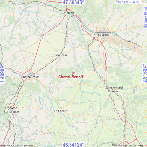
Chezal-Benoît GPS coordinates[2]
46° 49' 28.2" North, 2° 6' 47.232" East
| Map corner | latitude | longitude |
|---|---|---|
| Upper-left | 47.30345°, | 1.40999° |
| Center: | 46.8245°, | 2.11312° |
| Lower-right: | 46.34124°, | 2.81624° |
| Map W x H: | 107×107 km | = 66.5×66.5mi |
| max Lat: | 51.07786° ⇑57% North |
| Chezal-Benoît: | 46.8245° |
| min Lat: | ⇓43% South 41.3874° |
| min Long | Chezal-Benoît | max Long |
| -5.08615° | 2.11312° | 9.52242° |
| W 44.3%⇐ | ⇒55.7% E |
Elevation
Elevation of Chezal-Benoît is 179 m = 587 ft, and this is 14.7 m = 48 ft below average elevation for this country.
| Max E: |
2333 m = 7654 ft | 38.1% |
| Avg. | 193.7 m = 635 ft | |
| Chezal-Benoît | 179 m = 587 ft | |
Min E: |
-1 m = -3 ft | 61.9% |
See also: France elevation on elevation.city.
Geographical zone
Chezal-Benoît is located in North temperate zone (between Tropic of Cancer and the Arctic Circle). Distance of this North polar circle is 2194.8 km =1363.8 mi to North.| Distance of | km | miles | from Chezal-Benoît |
|---|---|---|---|
| North Pole | 4800.7 | 2983 | to North |
| Arctic Circle | 2194.8 | 1363.8 | to North |
| Tropic Cancer | 2600.5 | 1615.9 | to South |
| Equator | 5206.4 | 3235.1 | to South |


Nearby cities:
15 places around Chezal-Benoît: (largest is in red/bold)
• Ambrault
12.6 km =7.8 mi,  248°
248°
• Chârost
18.8 km =11.7 mi,  0°
0°
• Châteauneuf-sur-Cher
15.9 km =9.9 mi,  76°
76°
• Civray
16.5 km =10.3 mi,  16°
16°
• Issoudun
16.5 km =10.3 mi,  326°
326°
• Lignières
9.3 km =5.8 mi,  150°
150°
• Lunery
17.1 km =10.6 mi,  43°
43°
• Mareuil-sur-Arnon
7.2 km =4.5 mi,  30°
30°
• Mâron
19.1 km =11.9 mi,  264°
264°
• Neuvy-Pailloux
20.3 km =12.6 mi,  289°
289°
• Pruniers
6.2 km =3.9 mi,  230°
230°
• Saint-Août
15.3 km =9.5 mi, 227°
• Saint-Hilaire-en-Lignières
11.9 km =7.4 mi,  157°
157°
• Vallenay
20.1 km =12.5 mi,  102°
102°
• Venesmes
15.2 km =9.4 mi, 83°
Sources, notices
• [Note1] Compared only with cities in France existing in our database
• [Src1] Map data: © OpenStreetMap contributors (CC-BY-SA)
• [Src2] Other city data from geonames.org with taken over terms of usage.
• [Src3] Geographical zone / Annual Mean Temperature by Robert A. Rohde @ Wikipedia
