Mareuil-sur-Arnon geodata
Mareuil-sur-Arnon (Centre) is a populated place; located in France in Europe/Paris (GMT+2) time zone. With population of 604 people, there are 13253 cities with bigger population in this country. Compared to other cities in France, 56.4% of cities are located further ↑North; 55% of cities are located further →East and 54.7% of cities have lower elevation than Mareuil-sur-Arnon. Note1
Administrative division(s):
- Level 1: Centre
- Level 2: Cher
- Level 3: Arrondissement de Bourges
- Level 4: Mareuil-sur-Arnon


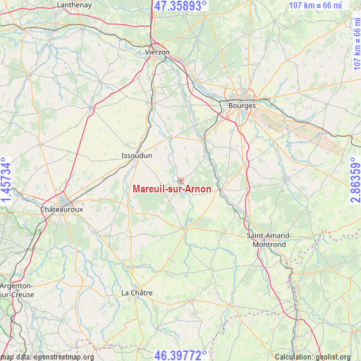
Mareuil-sur-Arnon GPS coordinates[2]
46° 52' 49.728" North, 2° 9' 37.656" East
| Map corner | latitude | longitude |
|---|---|---|
| Upper-left | 47.35893°, | 1.45734° |
| Center: | 46.88048°, | 2.16046° |
| Lower-right: | 46.39772°, | 2.86359° |
| Map W x H: | 106.9×106.9 km | = 66.4×66.4mi |
| max Lat: | 51.07786° ⇑56.4% North |
| Mareuil-sur-Arnon: | 46.88048° |
| min Lat: | ⇓43.6% South 41.3874° |
| min Long | Mareuil-sur-Arn | max Long |
| -5.08615° | 2.16046° | 9.52242° |
| W 45%⇐ | ⇒55% E |
Elevation
Elevation of Mareuil-sur-Arnon is 149 m = 489 ft, and this is 44.7 m = 147 ft below average elevation for this country.
| Max E: |
2333 m = 7654 ft | 45.3% |
| Avg. | 193.7 m = 635 ft | |
| Mareuil-sur-Arnon | 149 m = 489 ft | |
Min E: |
-1 m = -3 ft | 54.7% |
See also: France elevation on elevation.city.
Geographical zone
Mareuil-sur-Arnon is located in North temperate zone (between Tropic of Cancer and the Arctic Circle). Distance of this North polar circle is 2188.6 km =1359.9 mi to North.| Distance of | km | miles | from Mareuil-sur-Arnon |
|---|---|---|---|
| North Pole | 4794.4 | 2979.1 | to North |
| Arctic Circle | 2188.6 | 1359.9 | to North |
| Tropic Cancer | 2606.7 | 1619.7 | to South |
| Equator | 5212.6 | 3239 | to South |


Nearby cities:
15 places around Mareuil-sur-Arnon: (largest is in red/bold)
• Ambrault
18.7 km =11.6 mi,  234°
234°
• Chezal-Benoît
7.2 km =4.5 mi,  210°
210°
• Chârost
13 km =8.1 mi,  345°
345°
• Châteauneuf-sur-Cher
12.2 km =7.6 mi,  101°
101°
• Civray
9.6 km =6 mi,  6°
6°
• Issoudun
14.8 km =9.2 mi,  300°
300°
• Le Subdray
17.8 km =11.1 mi,  34°
34°
• Les Bordes
18.1 km =11.2 mi,  308°
308°
• Lignières
14.4 km =8.9 mi,  175°
175°
• Lunery
10.3 km =6.4 mi,  53°
53°
• Pruniers
13.2 km =8.2 mi,  219°
219°
• Saint-Florent-sur-Cher
14.5 km =9 mi, 28°
• Saint-Hilaire-en-Lignières
17.2 km =10.7 mi, 176°
• Sainte-Lizaigne
17.5 km =10.9 mi,  323°
323°
• Venesmes
12.4 km =7.7 mi,  111°
111°
Sources, notices
• [Note1] Compared only with cities in France existing in our database
• [Src1] Map data: © OpenStreetMap contributors (CC-BY-SA)
• [Src2] Other city data from geonames.org with taken over terms of usage.
• [Src3] Geographical zone / Annual Mean Temperature by Robert A. Rohde @ Wikipedia
