Lumbres geodata
Lumbres (Hauts-de-France) is a populated place; located in France in Europe/Paris (GMT+2) time zone. With population of 4,097 people, there are 2396 cities with bigger population in this country. Compared to other cities in France, 98.9% of cities are located further ↓South; 55.6% of cities are located further →East and 79.8% of cities have higher elevation than Lumbres. Note1
Administrative division(s):
- Level 1: Hauts-de-France
- Level 2: Pas-de-Calais
- Level 3: Arrondissement de Saint-Omer
- Level 4: Lumbres


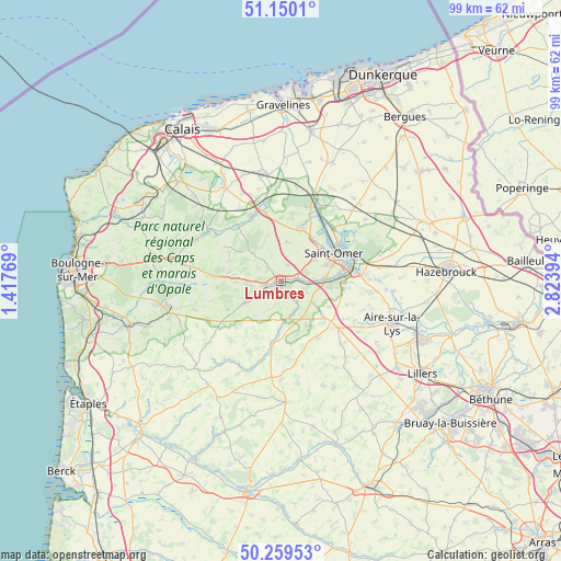
Lumbres GPS coordinates[2]
50° 42' 24.948" North, 2° 7' 14.916" East
| Map corner | latitude | longitude |
|---|---|---|
| Upper-left | 51.1501°, | 1.41769° |
| Center: | 50.70693°, | 2.12081° |
| Lower-right: | 50.25953°, | 2.82394° |
| Map W x H: | 99×99 km | = 61.5×61.5mi |
| max Lat: | 51.07786° ⇑1.1% North |
| Lumbres: | 50.70693° |
| min Lat: | ⇓98.9% South 41.3874° |
| min Long | Lumbres | max Long |
| -5.08615° | 2.12081° | 9.52242° |
| W 44.4%⇐ | ⇒55.6% E |
Elevation
Elevation of Lumbres is 55 m = 180 ft, and this is 138.7 m = 455 ft below average elevation for this country.
| Max E: |
2333 m = 7654 ft | 79.8% |
| Avg. | 193.7 m = 635 ft | |
| Lumbres | 55 m = 180 ft | |
Min E: |
-1 m = -3 ft | 20.2% |
See also: France elevation on elevation.city.
Geographical zone
Lumbres is located in North temperate zone (between Tropic of Cancer and the Arctic Circle). Distance of this North polar circle is 1763.1 km =1095.5 mi to North.| Distance of | km | miles | from Lumbres |
|---|---|---|---|
| North Pole | 4369 | 2714.8 | to North |
| Arctic Circle | 1763.1 | 1095.5 | to North |
| Tropic Cancer | 3032.2 | 1884.1 | to South |
| Equator | 5638.1 | 3503.4 | to South |


Nearby cities:
15 places around Lumbres: (largest is in red/bold)
• Acquin-Westbécourt
3.2 km =2 mi,  316°
316°
• Avroult
8.4 km =5.2 mi,  167°
167°
• Cléty
7.5 km =4.7 mi,  142°
142°
• Elnes
2 km =1.2 mi, 168°
• Esquerdes
4.8 km =3 mi,  93°
93°
• Hallines
7.4 km =4.6 mi, 86°
• Longuenesse
8.6 km =5.3 mi,  69°
69°
• Nielles-lès-Bléquin
7.3 km =4.5 mi,  240°
240°
• Ouve-Wirquin
6.7 km =4.2 mi, 170°
• Pihem
7.1 km =4.4 mi,  112°
112°
• Seninghem
6.3 km =3.9 mi,  265°
265°
• Setques
2.7 km =1.7 mi,  78°
78°
• Tatinghem
7.3 km =4.5 mi,  56°
56°
• Wismes
6.8 km =4.2 mi,  210°
210°
• Zudausques
5 km =3.1 mi,  22°
22°
Sources, notices
• [Note1] Compared only with cities in France existing in our database
• [Src1] Map data: © OpenStreetMap contributors (CC-BY-SA)
• [Src2] Other city data from geonames.org with taken over terms of usage.
• [Src3] Geographical zone / Annual Mean Temperature by Robert A. Rohde @ Wikipedia
