Loulay geodata
Loulay (Nouvelle-Aquitaine) is a populated place; located in France in Europe/Paris (GMT+2) time zone. With population of 831 people, there are 10280 cities with bigger population in this country. Compared to other cities in France, 65.7% of cities are located further ↑North; 83.6% of cities are located further →East and 80.2% of cities have higher elevation than Loulay. Note1
Administrative division(s):
- Level 1: Nouvelle-Aquitaine
- Level 2: Charente-Maritime
- Level 3: Arrondissement de Saint-Jean-d'Angély
- Level 4: Loulay


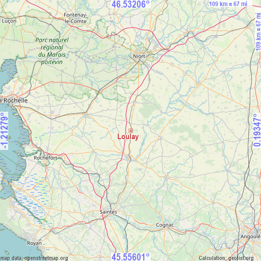
Loulay GPS coordinates[2]
46° 2' 46.284" North, 0° 30' 34.776" West
| Map corner | latitude | longitude |
|---|---|---|
| Upper-left | 46.53206°, | -1.21279° |
| Center: | 46.04619°, | -0.50966° |
| Lower-right: | 45.55601°, | 0.19347° |
| Map W x H: | 108.5×108.5 km | = 67.4×67.4mi |
| max Lat: | 51.07786° ⇑65.7% North |
| Loulay: | 46.04619° |
| min Lat: | ⇓34.3% South 41.3874° |
| min Long | Loulay | max Long |
| -5.08615° | -0.50966° | 9.52242° |
| W 16.4%⇐ | ⇒83.6% E |
Elevation
Elevation of Loulay is 54 m = 177 ft, and this is 139.7 m = 458 ft below average elevation for this country.
| Max E: |
2333 m = 7654 ft | 80.2% |
| Avg. | 193.7 m = 635 ft | |
| Loulay | 54 m = 177 ft | |
Min E: |
-1 m = -3 ft | 19.8% |
See also: France elevation on elevation.city.
Geographical zone
Loulay is located in North temperate zone (between Tropic of Cancer and the Arctic Circle). Distance of this North polar circle is 2281.3 km =1417.5 mi to North.| Distance of | km | miles | from Loulay |
|---|---|---|---|
| North Pole | 4887.2 | 3036.8 | to North |
| Arctic Circle | 2281.3 | 1417.5 | to North |
| Tropic Cancer | 2513.9 | 1562.1 | to South |
| Equator | 5119.9 | 3181.4 | to South |


Nearby cities:
15 places around Loulay: (largest is in red/bold)
• Aulnay
12.8 km =8 mi,  102°
102°
• Beauvoir-sur-Niort
15.3 km =9.5 mi,  10°
10°
• Bernay-Saint-Martin
8.6 km =5.3 mi,  285°
285°
• Chizé
14.7 km =9.1 mi,  58°
58°
• La Foye-Monjault
15.7 km =9.8 mi,  351°
351°
• La Vergne
10 km =6.2 mi,  205°
205°
• Landes
9 km =5.6 mi,  228°
228°
• Marsais
11.3 km =7 mi,  321°
321°
• Mazeray
15.9 km =9.9 mi,  194°
194°
• Prissé-la-Charrière
11.6 km =7.2 mi,  3°
3°
• Saint-Jean-d’Angély
11.4 km =7.1 mi,  184°
184°
• Saint-Mard
16.2 km =10.1 mi, 285°
• Usseau
15.2 km =9.4 mi,  339°
339°
• Varaize
15.2 km =9.4 mi,  154°
154°
• Villeneuve-la-Comtesse
5.8 km =3.6 mi, 4°
Sources, notices
• [Note1] Compared only with cities in France existing in our database
• [Src1] Map data: © OpenStreetMap contributors (CC-BY-SA)
• [Src2] Other city data from geonames.org with taken over terms of usage.
• [Src3] Geographical zone / Annual Mean Temperature by Robert A. Rohde @ Wikipedia
