Loubeyrat geodata
Loubeyrat (Auvergne-Rhône-Alpes) is a populated place; located in France in Europe/Paris (GMT+2) time zone. With population of 898 people, there are 9675 cities with bigger population in this country. Compared to other cities in France, 67.1% of cities are located further ↑North; 57.9% of cities are located further ←West and 96.6% of cities have lower elevation than Loubeyrat. Note1
Administrative division(s):
- Level 1: Auvergne-Rhône-Alpes
- Level 2: Département du Puy-de-Dôme
- Level 3: Arrondissement de Riom
- Level 4: Loubeyrat


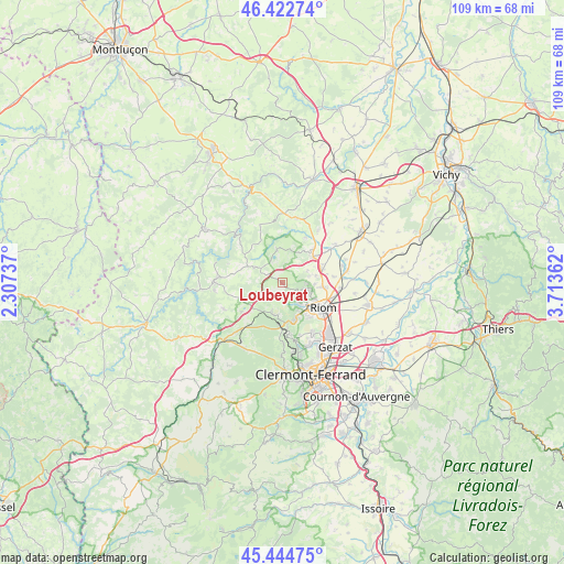
Loubeyrat GPS coordinates[2]
45° 56' 9.24" North, 3° 0' 37.764" East
| Map corner | latitude | longitude |
|---|---|---|
| Upper-left | 46.42274°, | 2.30737° |
| Center: | 45.9359°, | 3.01049° |
| Lower-right: | 45.44475°, | 3.71362° |
| Map W x H: | 108.7×108.7 km | = 67.5×67.5mi |
| max Lat: | 51.07786° ⇑67.1% North |
| Loubeyrat: | 45.9359° |
| min Lat: | ⇓32.9% South 41.3874° |
| min Long | Loubeyrat | max Long |
| -5.08615° | 3.01049° | 9.52242° |
| W 57.9%⇐ | ⇒42.1% E |
Elevation
Elevation of Loubeyrat is 685 m = 2247 ft, and this is 491.3 m = 1612 ft above average elevation for this country.
| Max E: |
2333 m = 7654 ft | 3.4% |
| Loubeyrat | 685 m 2247 ft | |
| Avg. | 193.7 m = 635 ft | |
Min E: |
-1 m = -3 ft | 96.6% |
See also: France elevation on elevation.city.
Geographical zone
Loubeyrat is located in North temperate zone (between Tropic of Cancer and the Arctic Circle). Distance of this North polar circle is 2293.6 km =1425.2 mi to North.| Distance of | km | miles | from Loubeyrat |
|---|---|---|---|
| North Pole | 4899.5 | 3044.4 | to North |
| Arctic Circle | 2293.6 | 1425.2 | to North |
| Tropic Cancer | 2501.7 | 1554.5 | to South |
| Equator | 5107.6 | 3173.7 | to South |


Nearby cities:
15 places around Loubeyrat: (largest is in red/bold)
• Beauregard-Vendon
8.2 km =5.1 mi,  71°
71°
• Cellule
10.1 km =6.3 mi,  82°
82°
• Charbonnières-les-Varennes
3.2 km =2 mi,  194°
194°
• Charbonnières-les-Vieilles
6.6 km =4.1 mi,  351°
351°
• Châtel-Guyon
4.4 km =2.7 mi,  109°
109°
• Combronde
7.8 km =4.8 mi,  50°
50°
• Davayat
7.7 km =4.8 mi, 80°
• Enval
5.1 km =3.2 mi,  143°
143°
• Malauzat
10.4 km =6.5 mi,  161°
161°
• Manzat
6.1 km =3.8 mi,  298°
298°
• Marsat
8.6 km =5.3 mi, 140°
• Mozac
8 km =5 mi,  125°
125°
• Riom
9.2 km =5.7 mi,  120°
120°
• Saint-Bonnet-près-Riom
8 km =5 mi,  94°
94°
• Volvic
7.4 km =4.6 mi, 163°
Sources, notices
• [Note1] Compared only with cities in France existing in our database
• [Src1] Map data: © OpenStreetMap contributors (CC-BY-SA)
• [Src2] Other city data from geonames.org with taken over terms of usage.
• [Src3] Geographical zone / Annual Mean Temperature by Robert A. Rohde @ Wikipedia
