Volvic geodata
Volvic (Auvergne-Rhône-Alpes) is a populated place; located in France in Europe/Paris (GMT+2) time zone. With population of 4,456 people, there are 2215 cities with bigger population in this country. Compared to other cities in France, 68.2% of cities are located further ↑North; 58.3% of cities are located further ←West and 92.9% of cities have lower elevation than Volvic. Note1
Administrative division(s):
- Level 1: Auvergne-Rhône-Alpes
- Level 2: Département du Puy-de-Dôme
- Level 3: Arrondissement de Riom
- Level 4: Volvic


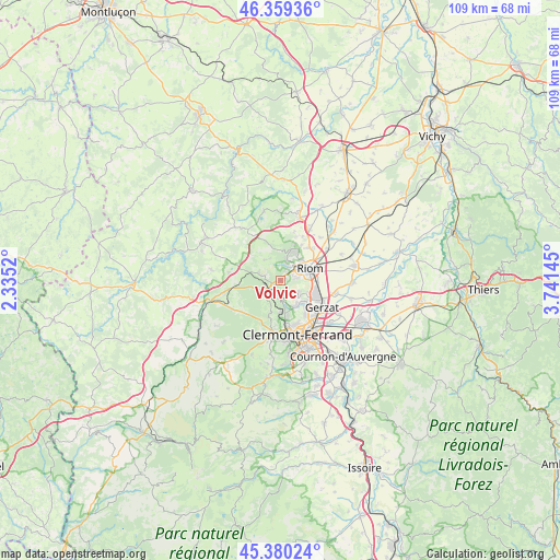
Volvic GPS coordinates[2]
45° 52' 19.056" North, 3° 2' 17.952" East
| Map corner | latitude | longitude |
|---|---|---|
| Upper-left | 46.35936°, | 2.3352° |
| Center: | 45.87196°, | 3.03832° |
| Lower-right: | 45.38024°, | 3.74145° |
| Map W x H: | 108.9×108.9 km | = 67.7×67.7mi |
| max Lat: | 51.07786° ⇑68.2% North |
| Volvic: | 45.87196° |
| min Lat: | ⇓31.8% South 41.3874° |
| min Long | Volvic | max Long |
| -5.08615° | 3.03832° | 9.52242° |
| W 58.3%⇐ | ⇒41.7% E |
Elevation
Elevation of Volvic is 502 m = 1647 ft, and this is 308.3 m = 1011 ft above average elevation for this country.
| Max E: |
2333 m = 7654 ft | 7.1% |
| Volvic | 502 m 1647 ft | |
| Avg. | 193.7 m = 635 ft | |
Min E: |
-1 m = -3 ft | 92.9% |
See also: France elevation on elevation.city.
Geographical zone
Volvic is located in North temperate zone (between Tropic of Cancer and the Arctic Circle). Distance of this North polar circle is 2300.7 km =1429.6 mi to North.| Distance of | km | miles | from Volvic |
|---|---|---|---|
| North Pole | 4906.6 | 3048.8 | to North |
| Arctic Circle | 2300.7 | 1429.6 | to North |
| Tropic Cancer | 2494.6 | 1550.1 | to South |
| Equator | 5100.5 | 3169.3 | to South |


Nearby cities:
15 places around Volvic: (largest is in red/bold)
• Blanzat
5.6 km =3.5 mi,  146°
146°
• Chanat-la-Mouteyre
4.9 km =3 mi,  201°
201°
• Charbonnières-les-Varennes
5 km =3.1 mi,  323°
323°
• Châteaugay
4.3 km =2.7 mi,  122°
122°
• Châtel-Guyon
6 km =3.7 mi,  19°
19°
• Cébazat
6.6 km =4.1 mi,  133°
133°
• Enval
3.2 km =2 mi, 16°
• Loubeyrat
7.4 km =4.6 mi,  343°
343°
• Malauzat
3 km =1.9 mi,  157°
157°
• Marsat
3.4 km =2.1 mi,  81°
81°
• Mozac
5 km =3.1 mi,  60°
60°
• Ménétrol
6.7 km =4.2 mi,  90°
90°
• Nohanent
7.2 km =4.5 mi,  169°
169°
• Riom
6.2 km =3.9 mi,  67°
67°
• Sayat
5.2 km =3.2 mi, 167°
Sources, notices
• [Note1] Compared only with cities in France existing in our database
• [Src1] Map data: © OpenStreetMap contributors (CC-BY-SA)
• [Src2] Other city data from geonames.org with taken over terms of usage.
• [Src3] Geographical zone / Annual Mean Temperature by Robert A. Rohde @ Wikipedia
