Longfossé geodata
Longfossé (Hauts-de-France) is a populated place; located in France in Europe/Paris (GMT+2) time zone. With population of 1,250 people, there are 7281 cities with bigger population in this country. Compared to other cities in France, 98.5% of cities are located further ↓South; 59.3% of cities are located further →East and 65.3% of cities have higher elevation than Longfossé. Note1
Administrative division(s):
- Level 1: Hauts-de-France
- Level 2: Pas-de-Calais
- Level 3: Arrondissement de Boulogne-sur-Mer
- Level 4: Longfossé


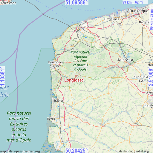
Longfossé GPS coordinates[2]
50° 39' 7.812" North, 1° 48' 24.948" East
| Map corner | latitude | longitude |
|---|---|---|
| Upper-left | 51.09586°, | 1.10381° |
| Center: | 50.65217°, | 1.80693° |
| Lower-right: | 50.20425°, | 2.51006° |
| Map W x H: | 99.1×99.1 km | = 61.6×61.6mi |
| max Lat: | 51.07786° ⇑1.5% North |
| Longfossé: | 50.65217° |
| min Lat: | ⇓98.5% South 41.3874° |
| min Long | Longfossé | max Long |
| -5.08615° | 1.80693° | 9.52242° |
| W 40.7%⇐ | ⇒59.3% E |
Elevation
Elevation of Longfossé is 89 m = 292 ft, and this is 104.7 m = 344 ft below average elevation for this country.
| Max E: |
2333 m = 7654 ft | 65.3% |
| Avg. | 193.7 m = 635 ft | |
| Longfossé | 89 m = 292 ft | |
Min E: |
-1 m = -3 ft | 34.7% |
See also: France elevation on elevation.city.
Geographical zone
Longfossé is located in North temperate zone (between Tropic of Cancer and the Arctic Circle). Distance of this North polar circle is 1769.2 km =1099.3 mi to North.| Distance of | km | miles | from Longfossé |
|---|---|---|---|
| North Pole | 4375.1 | 2718.6 | to North |
| Arctic Circle | 1769.2 | 1099.3 | to North |
| Tropic Cancer | 3026.1 | 1880.3 | to South |
| Equator | 5632 | 3499.6 | to South |


Nearby cities:
15 places around Longfossé: (largest is in red/bold)
• Belle-et-Houllefort
10.8 km =6.7 mi,  341°
341°
• Bourthes
10.3 km =6.4 mi,  120°
120°
• Carly
7.4 km =4.6 mi,  269°
269°
• Colembert
10.7 km =6.6 mi,  14°
14°
• Courset
2.6 km =1.6 mi,  104°
104°
• Crémarest
5.5 km =3.4 mi, 343°
• Desvres
2.7 km =1.7 mi,  46°
46°
• Hesdigneul-lès-Boulogne
10.3 km =6.4 mi,  275°
275°
• Isques
11 km =6.8 mi, 282°
• Menneville
5.1 km =3.2 mi, 54°
• Nesles
11 km =6.8 mi,  254°
254°
• Preures
10.2 km =6.3 mi,  149°
149°
• Quesques
10.6 km =6.6 mi,  57°
57°
• Samer
4.5 km =2.8 mi, 250°
• Wirwignes
4.8 km =3 mi,  318°
318°
Sources, notices
• [Note1] Compared only with cities in France existing in our database
• [Src1] Map data: © OpenStreetMap contributors (CC-BY-SA)
• [Src2] Other city data from geonames.org with taken over terms of usage.
• [Src3] Geographical zone / Annual Mean Temperature by Robert A. Rohde @ Wikipedia
