La Chapelle-Saint-Florent geodata
La Chapelle-Saint-Florent (Pays de la Loire) is a populated place; located in France in Europe/Paris (GMT+2) time zone. With population of 1,148 people, there are 7838 cities with bigger population in this country. Compared to other cities in France, 51% of cities are located further ↑North; 88.7% of cities are located further →East and 68.7% of cities have higher elevation than La Chapelle-Saint-Florent. Note1
Administrative division(s):
- Level 1: Pays de la Loire
- Level 2: Département de Maine-et-Loire
- Level 3: Arrondissement de Cholet
- Level 4: Mauges-sur-Loire
Current local time in La Chapelle-Saint-Florent:
12:47 PM, SaturdayDifference from your time zone: hours


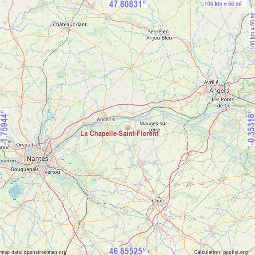
La Chapelle-Saint-Florent GPS coordinates[2]
47° 20' 2.148" North, 1° 3' 22.716" West
| Map corner | latitude | longitude |
|---|---|---|
| Upper-left | 47.80831°, | -1.75944° |
| Center: | 47.33393°, | -1.05631° |
| Lower-right: | 46.85525°, | -0.35318° |
| Map W x H: | 106×106 km | = 65.9×65.9mi |
| max Lat: | 51.07786° ⇑51% North |
| La Chapelle-Saint-Florent: | 47.33393° |
| min Lat: | ⇓49% South 41.3874° |
| min Long | La Chapelle-Sai | max Long |
| -5.08615° | -1.05631° | 9.52242° |
| W 11.3%⇐ | ⇒88.7% E |
Elevation
Elevation of La Chapelle-Saint-Florent is 81 m = 266 ft, and this is 112.7 m = 370 ft below average elevation for this country.
| Max E: |
2333 m = 7654 ft | 68.7% |
| Avg. | 193.7 m = 635 ft | |
| La Chapelle-Saint-Florent | 81 m = 266 ft | |
Min E: |
-1 m = -3 ft | 31.3% |
See also: France elevation on elevation.city.
Geographical zone
La Chapelle-Saint-Florent is located in North temperate zone (between Tropic of Cancer and the Arctic Circle). Distance of this North polar circle is 2138.1 km =1328.6 mi to North.| Distance of | km | miles | from La Chapelle-Saint-Florent |
|---|---|---|---|
| North Pole | 4744 | 2947.8 | to North |
| Arctic Circle | 2138.1 | 1328.6 | to North |
| Tropic Cancer | 2657.1 | 1651 | to South |
| Equator | 5263 | 3270.3 | to South |


Nearby cities:
15 places around La Chapelle-Saint-Florent: (largest is in red/bold)
• Ancenis
9.1 km =5.7 mi,  293°
293°
• Anetz
6.4 km =4 mi,  324°
324°
• Botz-en-Mauges
5.1 km =3.2 mi,  125°
125°
• Bouzillé
4.2 km =2.6 mi,  275°
275°
• Chaudron-en-Mauges
7.4 km =4.6 mi, 133°
• Le Fuilet
7.1 km =4.4 mi,  217°
217°
• Le Marillais
3 km =1.9 mi,  329°
329°
• Liré
8.3 km =5.2 mi, 277°
• Montrevault
8.3 km =5.2 mi,  175°
175°
• Saint-Florent-le-Vieil
4.3 km =2.7 mi,  46°
46°
• Saint-Herblon
8.8 km =5.5 mi,  339°
339°
• Saint-Laurent-du-Mottay
8.3 km =5.2 mi,  76°
76°
• Saint-Pierre-Montlimart
7.5 km =4.7 mi,  163°
163°
• Saint-Rémy-en-Mauges
7 km =4.3 mi,  191°
191°
• Varades
6 km =3.7 mi,  20°
20°
Sources, notices
• [Note1] Compared only with cities in France existing in our database
• [Src1] Map data: © OpenStreetMap contributors (CC-BY-SA)
• [Src2] Other city data from geonames.org with taken over terms of usage.
• [Src3] Geographical zone / Annual Mean Temperature by Robert A. Rohde @ Wikipedia
