Mésanger geodata
Mésanger (Pays de la Loire) is a populated place; located in France in Europe/Paris (GMT+2) time zone. With population of 3,435 people, there are 2828 cities with bigger population in this country. Compared to other cities in France, 50.2% of cities are located further ↓South; 90.2% of cities are located further →East and 86.2% of cities have higher elevation than Mésanger. Note1
Administrative division(s):
- Level 1: Pays de la Loire
- Level 2: Loire-Atlantique
- Level 3: Arrondissement of Châteaubriant-Ancenis
- Level 4: Mésanger


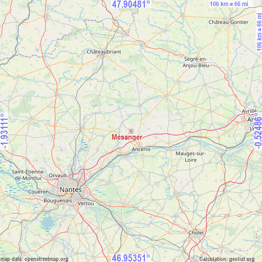
Mésanger GPS coordinates[2]
47° 25' 52.716" North, 1° 13' 40.728" West
| Map corner | latitude | longitude |
|---|---|---|
| Upper-left | 47.90481°, | -1.93111° |
| Center: | 47.43131°, | -1.22798° |
| Lower-right: | 46.95351°, | -0.52486° |
| Map W x H: | 105.8×105.8 km | = 65.7×65.7mi |
| max Lat: | 51.07786° ⇑49.8% North |
| Mésanger: | 47.43131° |
| min Lat: | ⇓50.2% South 41.3874° |
| min Long | Mésanger | max Long |
| -5.08615° | -1.22798° | 9.52242° |
| W 9.8%⇐ | ⇒90.2% E |
Elevation
Elevation of Mésanger is 39 m = 128 ft, and this is 154.7 m = 508 ft below average elevation for this country.
| Max E: |
2333 m = 7654 ft | 86.2% |
| Avg. | 193.7 m = 635 ft | |
| Mésanger | 39 m = 128 ft | |
Min E: |
-1 m = -3 ft | 13.8% |
See also: France elevation on elevation.city.
Geographical zone
Mésanger is located in North temperate zone (between Tropic of Cancer and the Arctic Circle). Distance of this North polar circle is 2127.3 km =1321.8 mi to North.| Distance of | km | miles | from Mésanger |
|---|---|---|---|
| North Pole | 4733.2 | 2941.1 | to North |
| Arctic Circle | 2127.3 | 1321.8 | to North |
| Tropic Cancer | 2667.9 | 1657.8 | to South |
| Equator | 5273.9 | 3277 | to South |


Nearby cities:
15 places around Mésanger: (largest is in red/bold)
• Ancenis
8.5 km =5.3 mi,  147°
147°
• Anetz
10.8 km =6.7 mi,  121°
121°
• Couffé
6.6 km =4.1 mi,  227°
227°
• Drain
10.6 km =6.6 mi,  171°
171°
• La Roche-Blanche
6.7 km =4.2 mi,  81°
81°
• Liré
10.9 km =6.8 mi, 154°
• Maumusson
10.8 km =6.7 mi,  58°
58°
• Mouzeil
9.2 km =5.7 mi,  281°
281°
• Oudon
10.2 km =6.3 mi,  204°
204°
• Pannecé
6.1 km =3.8 mi,  351°
351°
• Pouillé-les-Côteaux
5.6 km =3.5 mi, 61°
• Riaillé
10.8 km =6.7 mi,  332°
332°
• Saint-Géréon
7.3 km =4.5 mi,  164°
164°
• Saint-Herblon
10.2 km =6.3 mi,  104°
104°
• Teillé
5.1 km =3.2 mi,  311°
311°
Sources, notices
• [Note1] Compared only with cities in France existing in our database
• [Src1] Map data: © OpenStreetMap contributors (CC-BY-SA)
• [Src2] Other city data from geonames.org with taken over terms of usage.
• [Src3] Geographical zone / Annual Mean Temperature by Robert A. Rohde @ Wikipedia
