Ligny-Thilloy geodata
Ligny-Thilloy (Hauts-de-France) is a populated place; located in France in Europe/Paris (GMT+2) time zone. With population of 526 people, there are 14691 cities with bigger population in this country. Compared to other cities in France, 94.1% of cities are located further ↓South; 55.3% of cities are located further ←West and 60.4% of cities have higher elevation than Ligny-Thilloy. Note1
Administrative division(s):
- Level 1: Hauts-de-France
- Level 2: Pas-de-Calais
- Level 3: Arras
- Level 4: Ligny-Thilloy


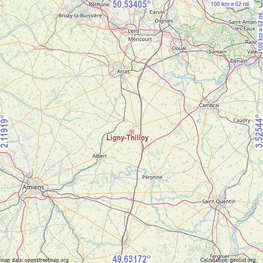
Ligny-Thilloy GPS coordinates[2]
50° 5' 6.036" North, 2° 49' 20.352" East
| Map corner | latitude | longitude |
|---|---|---|
| Upper-left | 50.53405°, | 2.11919° |
| Center: | 50.08501°, | 2.82232° |
| Lower-right: | 49.63172°, | 3.52544° |
| Map W x H: | 100.3×100.3 km | = 62.3×62.3mi |
| max Lat: | 51.07786° ⇑5.9% North |
| Ligny-Thilloy: | 50.08501° |
| min Lat: | ⇓94.1% South 41.3874° |
| min Long | Ligny-Thilloy | max Long |
| -5.08615° | 2.82232° | 9.52242° |
| W 55.3%⇐ | ⇒44.7% E |
Elevation
Elevation of Ligny-Thilloy is 101 m = 331 ft, and this is 92.7 m = 304 ft below average elevation for this country.
| Max E: |
2333 m = 7654 ft | 60.4% |
| Avg. | 193.7 m = 635 ft | |
| Ligny-Thilloy | 101 m = 331 ft | |
Min E: |
-1 m = -3 ft | 39.6% |
See also: France elevation on elevation.city.
Geographical zone
Ligny-Thilloy is located in North temperate zone (between Tropic of Cancer and the Arctic Circle). Distance of this North polar circle is 1832.2 km =1138.5 mi to North.| Distance of | km | miles | from Ligny-Thilloy |
|---|---|---|---|
| North Pole | 4438.1 | 2757.7 | to North |
| Arctic Circle | 1832.2 | 1138.5 | to North |
| Tropic Cancer | 2963 | 1841.1 | to South |
| Equator | 5568.9 | 3460.4 | to South |


Nearby cities:
15 places around Ligny-Thilloy: (largest is in red/bold)
• Achiet-le-Grand
5.9 km =3.7 mi,  329°
329°
• Albert
15.4 km =9.6 mi,  232°
232°
• Bapaume
2.9 km =1.8 mi,  43°
43°
• Beaumetz-lès-Cambrai
12.3 km =7.6 mi,  70°
70°
• Bertincourt
11.3 km =7 mi,  89°
89°
• Bucquoy
10 km =6.2 mi,  307°
307°
• Cléry-sur-Somme
15 km =9.3 mi,  161°
161°
• Combles
9 km =5.6 mi, 159°
• Croisilles
13.4 km =8.3 mi,  17°
17°
• Mailly-Maillet
15.5 km =9.6 mi,  268°
268°
• Miraumont
6.6 km =4.1 mi,  279°
279°
• Moislains
14.8 km =9.2 mi,  136°
136°
• Puisieux
9.8 km =6.1 mi,  290°
290°
• Quéant
15.5 km =9.6 mi,  47°
47°
• Vaulx-Vraucourt
9.4 km =5.8 mi, 40°
Sources, notices
• [Note1] Compared only with cities in France existing in our database
• [Src1] Map data: © OpenStreetMap contributors (CC-BY-SA)
• [Src2] Other city data from geonames.org with taken over terms of usage.
• [Src3] Geographical zone / Annual Mean Temperature by Robert A. Rohde @ Wikipedia
