Cléry-sur-Somme geodata
Cléry-sur-Somme (Hauts-de-France) is a populated place; located in France in Europe/Paris (GMT+2) time zone. With population of 529 people, there are 14624 cities with bigger population in this country. Compared to other cities in France, 93.4% of cities are located further ↓South; 56.2% of cities are located further ←West and 80.2% of cities have higher elevation than Cléry-sur-Somme. Note1
Administrative division(s):
- Level 1: Hauts-de-France
- Level 2: Somme
- Level 3: Arrondissement de Péronne
- Level 4: Cléry-sur-Somme


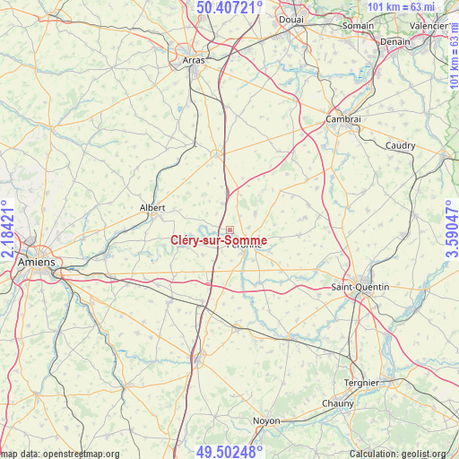
Cléry-sur-Somme GPS coordinates[2]
49° 57' 25.092" North, 2° 53' 14.424" East
| Map corner | latitude | longitude |
|---|---|---|
| Upper-left | 50.40721°, | 2.18421° |
| Center: | 49.95697°, | 2.88734° |
| Lower-right: | 49.50248°, | 3.59047° |
| Map W x H: | 100.6×100.6 km | = 62.5×62.5mi |
| max Lat: | 51.07786° ⇑6.6% North |
| Cléry-sur-Somme: | 49.95697° |
| min Lat: | ⇓93.4% South 41.3874° |
| min Long | Cléry-sur-Somm | max Long |
| -5.08615° | 2.88734° | 9.52242° |
| W 56.2%⇐ | ⇒43.8% E |
Elevation
Elevation of Cléry-sur-Somme is 54 m = 177 ft, and this is 139.7 m = 458 ft below average elevation for this country.
| Max E: |
2333 m = 7654 ft | 80.2% |
| Avg. | 193.7 m = 635 ft | |
| Cléry-sur-Somme | 54 m = 177 ft | |
Min E: |
-1 m = -3 ft | 19.8% |
See also: France elevation on elevation.city.
Geographical zone
Cléry-sur-Somme is located in North temperate zone (between Tropic of Cancer and the Arctic Circle). Distance of this North polar circle is 1846.5 km =1147.4 mi to North.| Distance of | km | miles | from Cléry-sur-Somme |
|---|---|---|---|
| North Pole | 4452.4 | 2766.6 | to North |
| Arctic Circle | 1846.5 | 1147.4 | to North |
| Tropic Cancer | 2948.8 | 1832.3 | to South |
| Equator | 5554.7 | 3451.5 | to South |


Nearby cities:
15 places around Cléry-sur-Somme: (largest is in red/bold)
• Athies
13.3 km =8.3 mi,  149°
149°
• Becquincourt
7.3 km =4.5 mi,  224°
224°
• Bertincourt
15.8 km =9.8 mi,  25°
25°
• Bray-sur-Somme
12.2 km =7.6 mi,  261°
261°
• Cartigny
10.3 km =6.4 mi,  119°
119°
• Combles
6 km =3.7 mi,  346°
346°
• Doingt
7 km =4.3 mi, 124°
• Estrées-Mons
12.3 km =7.6 mi,  135°
135°
• Heudicourt
15.6 km =9.7 mi,  62°
62°
• Ligny-Thilloy
15 km =9.3 mi,  341°
341°
• Moislains
6.5 km =4 mi, 57°
• Proyart
15.1 km =9.4 mi,  238°
238°
• Péronne
4.5 km =2.8 mi,  128°
128°
• Roisel
15.2 km =9.4 mi,  93°
93°
• Villers-Faucon
15.5 km =9.6 mi,  81°
81°
Sources, notices
• [Note1] Compared only with cities in France existing in our database
• [Src1] Map data: © OpenStreetMap contributors (CC-BY-SA)
• [Src2] Other city data from geonames.org with taken over terms of usage.
• [Src3] Geographical zone / Annual Mean Temperature by Robert A. Rohde @ Wikipedia
