Villers-Guislain geodata
Villers-Guislain (Hauts-de-France) is a populated place; located in France in Europe/Paris (GMT+2) time zone. With population of 654 people, there are 12467 cities with bigger population in this country. Compared to other cities in France, 93.8% of cities are located further ↓South; 60% of cities are located further ←West and 51.4% of cities have higher elevation than Villers-Guislain. Note1
Administrative division(s):
- Level 1: Hauts-de-France
- Level 2: Nord
- Level 3: Arrondissement de Cambrai
- Level 4: Villers-Guislain


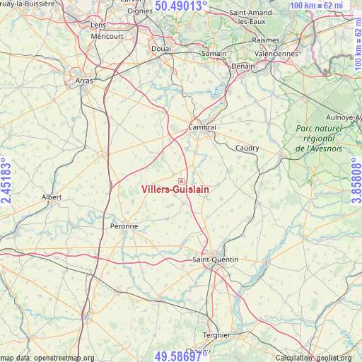
Villers-Guislain GPS coordinates[2]
50° 2' 26.412" North, 3° 9' 17.856" East
| Map corner | latitude | longitude |
|---|---|---|
| Upper-left | 50.49013°, | 2.45183° |
| Center: | 50.04067°, | 3.15496° |
| Lower-right: | 49.58697°, | 3.85808° |
| Map W x H: | 100.4×100.4 km | = 62.4×62.4mi |
| max Lat: | 51.07786° ⇑6.2% North |
| Villers-Guislain: | 50.04067° |
| min Lat: | ⇓93.8% South 41.3874° |
| min Long | Villers-Guislai | max Long |
| -5.08615° | 3.15496° | 9.52242° |
| W 60%⇐ | ⇒40% E |
Elevation
Elevation of Villers-Guislain is 127 m = 417 ft, and this is 66.7 m = 219 ft below average elevation for this country.
| Max E: |
2333 m = 7654 ft | 51.4% |
| Avg. | 193.7 m = 635 ft | |
| Villers-Guislain | 127 m = 417 ft | |
Min E: |
-1 m = -3 ft | 48.6% |
See also: France elevation on elevation.city.
Geographical zone
Villers-Guislain is located in North temperate zone (between Tropic of Cancer and the Arctic Circle). Distance of this North polar circle is 1837.2 km =1141.6 mi to North.| Distance of | km | miles | from Villers-Guislain |
|---|---|---|---|
| North Pole | 4443.1 | 2760.8 | to North |
| Arctic Circle | 1837.2 | 1141.6 | to North |
| Tropic Cancer | 2958.1 | 1838.1 | to South |
| Equator | 5564 | 3457.3 | to South |


Nearby cities:
15 places around Villers-Guislain: (largest is in red/bold)
• Bellicourt
10.5 km =6.5 mi,  146°
146°
• Gouy
8.4 km =5.2 mi,  121°
121°
• Gouzeaucourt
2.8 km =1.7 mi,  307°
307°
• Hargicourt
9 km =5.6 mi,  168°
168°
• Heudicourt
5.7 km =3.5 mi,  248°
248°
• Honnecourt-sur-Escaut
3.3 km =2.1 mi,  104°
104°
• Les Rues-des-Vignes
8.6 km =5.3 mi,  44°
44°
• Marcoing
9 km =5.6 mi,  8°
8°
• Masnières
9.1 km =5.7 mi,  25°
25°
• Metz-en-Couture
7.1 km =4.4 mi,  294°
294°
• Noyelles-sur-Escaut
10.5 km =6.5 mi, 11°
• Ronssoy
6.4 km =4 mi,  176°
176°
• Villers-Faucon
8 km =5 mi,  208°
208°
• Villers-Outréaux
10.3 km =6.4 mi,  92°
92°
• Épehy
4.8 km =3 mi,  198°
198°
Sources, notices
• [Note1] Compared only with cities in France existing in our database
• [Src1] Map data: © OpenStreetMap contributors (CC-BY-SA)
• [Src2] Other city data from geonames.org with taken over terms of usage.
• [Src3] Geographical zone / Annual Mean Temperature by Robert A. Rohde @ Wikipedia
