Les Contamines-Montjoie geodata
Les Contamines-Montjoie (Auvergne-Rhône-Alpes) is a populated place; located in France in Europe/Paris (GMT+2) time zone. With population of 1,127 people, there are 7965 cities with bigger population in this country. Compared to other cities in France, 69% of cities are located further ↑North; 93.2% of cities are located further ←West and 99.6% of cities have lower elevation than Les Contamines-Montjoie. Note1
Administrative division(s):
- Level 1: Auvergne-Rhône-Alpes
- Level 2: Haute-Savoie
- Level 3: Arrondissement de Bonneville
- Level 4: Les Contamines-Montjoie
Current local time in Les Contamines-Montjoie:
07:23 PM, SaturdayDifference from your time zone: hours


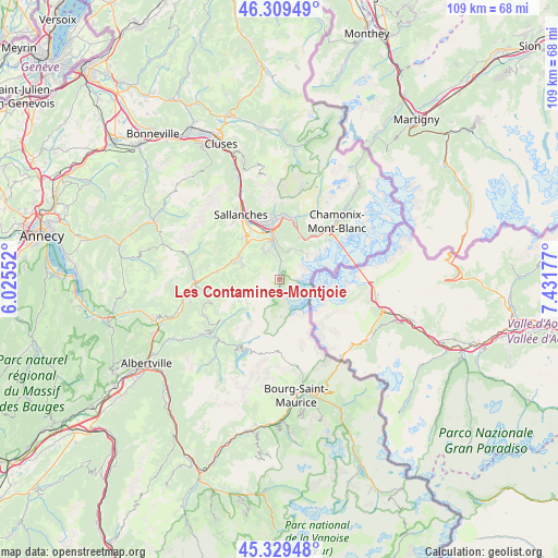
Les Contamines-Montjoie GPS coordinates[2]
45° 49' 17.904" North, 6° 43' 43.14" East
| Map corner | latitude | longitude |
|---|---|---|
| Upper-left | 46.30949°, | 6.02552° |
| Center: | 45.82164°, | 6.72865° |
| Lower-right: | 45.32948°, | 7.43177° |
| Map W x H: | 109×109 km | = 67.7×67.7mi |
| max Lat: | 51.07786° ⇑69% North |
| Les Contamines-Montjoie: | 45.82164° |
| min Lat: | ⇓31% South 41.3874° |
| min Long | Les Contamines- | max Long |
| -5.08615° | 6.72865° | 9.52242° |
| W 93.2%⇐ | ⇒6.8% E |
Elevation
Elevation of Les Contamines-Montjoie is 1176 m = 3858 ft, and this is 982.3 m = 3223 ft above average elevation for this country.
| Max E: |
2333 m = 7654 ft | 0.40000000000001% |
| Les Contamines-Montjoie | 1176 m 3858 ft | |
| Avg. | 193.7 m = 635 ft | |
Min E: |
-1 m = -3 ft | 99.6% |
See also: France elevation on elevation.city.
Geographical zone
Les Contamines-Montjoie is located in North temperate zone (between Tropic of Cancer and the Arctic Circle). Distance of this North polar circle is 2306.3 km =1433.1 mi to North.| Distance of | km | miles | from Les Contamines-Montjoie |
|---|---|---|---|
| North Pole | 4912.2 | 3052.3 | to North |
| Arctic Circle | 2306.3 | 1433.1 | to North |
| Tropic Cancer | 2489 | 1546.6 | to South |
| Equator | 5094.9 | 3165.8 | to South |


Nearby cities:
15 places around Les Contamines-Montjoie: (largest is in red/bold)
• Beaufort
16.6 km =10.3 mi,  226°
226°
• Chamonix-Mont-Blanc
15.7 km =9.8 mi,  43°
43°
• Combloux
10.7 km =6.6 mi,  322°
322°
• Cordon
14.6 km =9.1 mi, 319°
• Domancy
11.6 km =7.2 mi,  329°
329°
• Flumet
16.6 km =10.3 mi,  268°
268°
• Hauteluce
14 km =8.7 mi, 234°
• Les Houches
9.9 km =6.2 mi, 37°
• Megève
9.4 km =5.8 mi,  294°
294°
• Notre-Dame-de-Bellecombe
16.4 km =10.2 mi,  264°
264°
• Passy
11.6 km =7.2 mi,  347°
347°
• Praz-sur-Arly
12.2 km =7.6 mi,  278°
278°
• Saint-Gervais-les-Bains
7.8 km =4.8 mi, 353°
• Sallanches
15.6 km =9.7 mi, 331°
• Servoz
12.5 km =7.8 mi,  11°
11°
Sources, notices
• [Note1] Compared only with cities in France existing in our database
• [Src1] Map data: © OpenStreetMap contributors (CC-BY-SA)
• [Src2] Other city data from geonames.org with taken over terms of usage.
• [Src3] Geographical zone / Annual Mean Temperature by Robert A. Rohde @ Wikipedia
