Les Châtelliers-Châteaumur geodata
Les Châtelliers-Châteaumur (Pays de la Loire) is a populated place; located in France in Europe/Paris (GMT+2) time zone. With population of 731 people, there are 11400 cities with bigger population in this country. Compared to other cities in France, 56.6% of cities are located further ↑North; 86.6% of cities are located further →East and 65.6% of cities have lower elevation than Les Châtelliers-Châteaumur. Note1
Administrative division(s):
- Level 1: Pays de la Loire
- Level 2: Département de la Vendée
- Level 3: Arrondissement de Fontenay-le-Comte
- Level 4: Sèvremont
Current local time in Les Châtelliers-Châteaumur:
09:59 AM, SaturdayDifference from your time zone: hours


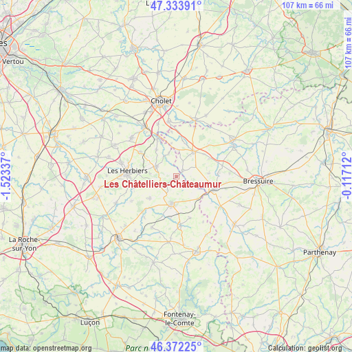
Les Châtelliers-Châteaumur GPS coordinates[2]
46° 51' 18.828" North, 0° 49' 12.864" West
| Map corner | latitude | longitude |
|---|---|---|
| Upper-left | 47.33391°, | -1.52337° |
| Center: | 46.85523°, | -0.82024° |
| Lower-right: | 46.37225°, | -0.11712° |
| Map W x H: | 106.9×106.9 km | = 66.4×66.4mi |
| max Lat: | 51.07786° ⇑56.6% North |
| Les Châtelliers-Châteaumur: | 46.85523° |
| min Lat: | ⇓43.4% South 41.3874° |
| min Long | Les Châtellier | max Long |
| -5.08615° | -0.82024° | 9.52242° |
| W 13.4%⇐ | ⇒86.6% E |
Elevation
Elevation of Les Châtelliers-Châteaumur is 197 m = 646 ft, and this is 3.3 m = 11 ft above average elevation for this country.
| Max E: |
2333 m = 7654 ft | 34.4% |
| Les Châtelliers-Châteaumur | 197 m 646 ft | |
| Avg. | 193.7 m = 635 ft | |
Min E: |
-1 m = -3 ft | 65.6% |
See also: France elevation on elevation.city.
Geographical zone
Les Châtelliers-Châteaumur is located in North temperate zone (between Tropic of Cancer and the Arctic Circle). Distance of this North polar circle is 2191.4 km =1361.7 mi to North.| Distance of | km | miles | from Les Châtelliers-Châteaumur |
|---|---|---|---|
| North Pole | 4797.2 | 2980.8 | to North |
| Arctic Circle | 2191.4 | 1361.7 | to North |
| Tropic Cancer | 2603.9 | 1618 | to South |
| Equator | 5209.8 | 3237.2 | to South |


Nearby cities:
15 places around Les Châtelliers-Châteaumur: (largest is in red/bold)
• Cerizay
12.4 km =7.7 mi,  107°
107°
• Combrand
10 km =6.2 mi,  84°
84°
• La Flocellière
4.1 km =2.5 mi,  231°
231°
• La Petite-Boissière
6.7 km =4.2 mi,  61°
61°
• La Pommeraie-sur-Sèvre
3.9 km =2.4 mi,  124°
124°
• Le Boupère
10.4 km =6.5 mi, 230°
• Le Pin
12.6 km =7.8 mi,  86°
86°
• Les Epesses
6.8 km =4.2 mi,  297°
297°
• Pouzauges
8.5 km =5.3 mi,  188°
188°
• Saint-Amand-sur-Sèvre
2.4 km =1.5 mi,  49°
49°
• Saint-Malô-du-Bois
10.6 km =6.6 mi,  325°
325°
• Saint-Mars-la-Réorthe
8 km =5 mi,  275°
275°
• Saint-Mesmin
9.6 km =6 mi,  135°
135°
• Saint-Michel-Mont-Mercure
5.6 km =3.5 mi,  238°
238°
• Treize-Vents
7.6 km =4.7 mi,  343°
343°
Sources, notices
• [Note1] Compared only with cities in France existing in our database
• [Src1] Map data: © OpenStreetMap contributors (CC-BY-SA)
• [Src2] Other city data from geonames.org with taken over terms of usage.
• [Src3] Geographical zone / Annual Mean Temperature by Robert A. Rohde @ Wikipedia
