Saint-Malô-du-Bois geodata
Saint-Malô-du-Bois (Pays de la Loire) is a populated place; located in France in Europe/Paris (GMT+2) time zone. With population of 1,291 people, there are 7077 cities with bigger population in this country. Compared to other cities in France, 56% of cities are located further ↑North; 87.3% of cities are located further →East and 64.9% of cities have lower elevation than Saint-Malô-du-Bois. Note1
Administrative division(s):
- Level 1: Pays de la Loire
- Level 2: Département de la Vendée
- Level 3: Arrondissement de La Roche-sur-Yon
- Level 4: Saint-Malô-du-Bois


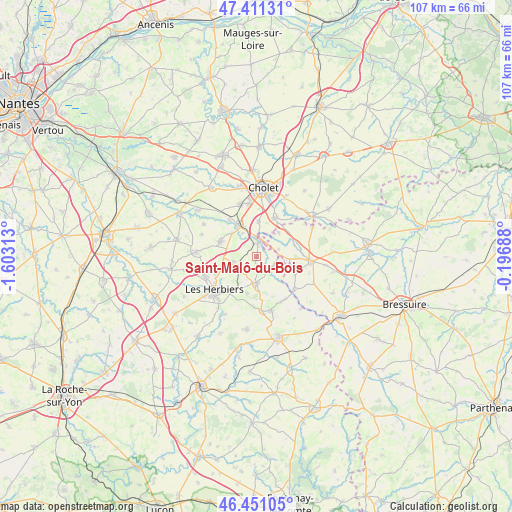
Saint-Malô-du-Bois GPS coordinates[2]
46° 55' 59.988" North, 0° 54' 0" West
| Map corner | latitude | longitude |
|---|---|---|
| Upper-left | 47.41131°, | -1.60313° |
| Center: | 46.93333°, | -0.9° |
| Lower-right: | 46.45105°, | -0.19688° |
| Map W x H: | 106.8×106.8 km | = 66.4×66.4mi |
| max Lat: | 51.07786° ⇑56% North |
| Saint-Malô-du-Bois: | 46.93333° |
| min Lat: | ⇓44% South 41.3874° |
| min Long | Saint-Malô-du- | max Long |
| -5.08615° | -0.9° | 9.52242° |
| W 12.7%⇐ | ⇒87.3% E |
Elevation
Elevation of Saint-Malô-du-Bois is 193 m = 633 ft, and this is 0.69999999999999 m = 2 ft below average elevation for this country.
| Max E: |
2333 m = 7654 ft | 35.1% |
| Avg. | 193.7 m = 635 ft | |
| Saint-Malô-du-Bois | 193 m = 633 ft | |
Min E: |
-1 m = -3 ft | 64.9% |
See also: France elevation on elevation.city.
Geographical zone
Saint-Malô-du-Bois is located in North temperate zone (between Tropic of Cancer and the Arctic Circle). Distance of this North polar circle is 2182.7 km =1356.3 mi to North.| Distance of | km | miles | from Saint-Malô-du-Bois |
|---|---|---|---|
| North Pole | 4788.6 | 2975.5 | to North |
| Arctic Circle | 2182.7 | 1356.3 | to North |
| Tropic Cancer | 2612.6 | 1623.4 | to South |
| Equator | 5218.5 | 3242.6 | to South |


Nearby cities:
15 places around Saint-Malô-du-Bois: (largest is in red/bold)
• Chambretaud
5 km =3.1 mi,  255°
255°
• La Flocellière
11.6 km =7.2 mi,  165°
165°
• La Tessoualle
8.8 km =5.5 mi,  24°
24°
• La Verrie
7.9 km =4.9 mi,  293°
293°
• Les Châtelliers-Châteaumur
10.6 km =6.6 mi,  145°
145°
• Les Epesses
5.6 km =3.5 mi,  180°
180°
• Les Herbiers
11.6 km =7.2 mi,  230°
230°
• Mortagne-sur-Sèvre
7.5 km =4.7 mi,  331°
331°
• Saint-Amand-sur-Sèvre
10.6 km =6.6 mi,  131°
131°
• Saint-Christophe-du-Bois
11.3 km =7 mi,  342°
342°
• Saint-Laurent-sur-Sèvre
2.8 km =1.7 mi,  9°
9°
• Saint-Mars-la-Réorthe
8.1 km =5 mi,  193°
193°
• Saint-Martin-des-Tilleuls
12.2 km =7.6 mi, 291°
• Saint-Michel-Mont-Mercure
11.6 km =7.2 mi, 173°
• Treize-Vents
4.1 km =2.5 mi,  109°
109°
Sources, notices
• [Note1] Compared only with cities in France existing in our database
• [Src1] Map data: © OpenStreetMap contributors (CC-BY-SA)
• [Src2] Other city data from geonames.org with taken over terms of usage.
• [Src3] Geographical zone / Annual Mean Temperature by Robert A. Rohde @ Wikipedia
