La Petite-Boissière geodata
La Petite-Boissière (Nouvelle-Aquitaine) is a populated place; located in France in Europe/Paris (GMT+2) time zone. With population of 632 people, there are 12784 cities with bigger population in this country. Compared to other cities in France, 56.3% of cities are located further ↑North; 85.9% of cities are located further →East and 62.5% of cities have lower elevation than La Petite-Boissière. Note1
Administrative division(s):
- Level 1: Nouvelle-Aquitaine
- Level 2: Département des Deux-Sèvres
- Level 3: Arrondissement de Bressuire
- Level 4: La Petite-Boissière


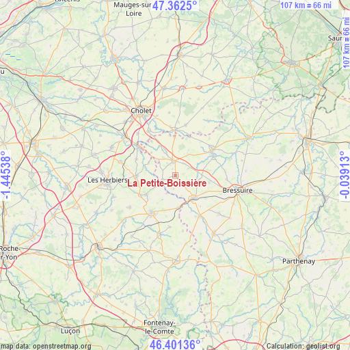
La Petite-Boissière GPS coordinates[2]
46° 53' 2.688" North, 0° 44' 32.136" West
| Map corner | latitude | longitude |
|---|---|---|
| Upper-left | 47.3625°, | -1.44538° |
| Center: | 46.88408°, | -0.74226° |
| Lower-right: | 46.40136°, | -0.03913° |
| Map W x H: | 106.9×106.9 km | = 66.4×66.4mi |
| max Lat: | 51.07786° ⇑56.3% North |
| La Petite-Boissière: | 46.88408° |
| min Lat: | ⇓43.7% South 41.3874° |
| min Long | La Petite-Boiss | max Long |
| -5.08615° | -0.74226° | 9.52242° |
| W 14.1%⇐ | ⇒85.9% E |
Elevation
Elevation of La Petite-Boissière is 182 m = 597 ft, and this is 11.7 m = 38 ft below average elevation for this country.
| Max E: |
2333 m = 7654 ft | 37.5% |
| Avg. | 193.7 m = 635 ft | |
| La Petite-Boissière | 182 m = 597 ft | |
Min E: |
-1 m = -3 ft | 62.5% |
See also: France elevation on elevation.city.
Geographical zone
La Petite-Boissière is located in North temperate zone (between Tropic of Cancer and the Arctic Circle). Distance of this North polar circle is 2188.2 km =1359.7 mi to North.| Distance of | km | miles | from La Petite-Boissière |
|---|---|---|---|
| North Pole | 4794 | 2978.9 | to North |
| Arctic Circle | 2188.2 | 1359.7 | to North |
| Tropic Cancer | 2607.1 | 1620 | to South |
| Equator | 5213 | 3239.2 | to South |


Nearby cities:
15 places around La Petite-Boissière: (largest is in red/bold)
• Bretignolles
10.5 km =6.5 mi,  102°
102°
• Cerizay
9.1 km =5.7 mi,  139°
139°
• Combrand
4.6 km =2.9 mi,  118°
118°
• La Flocellière
10.8 km =6.7 mi,  237°
237°
• La Pommeraie-sur-Sèvre
6.1 km =3.8 mi,  206°
206°
• Le Pin
7 km =4.3 mi,  109°
109°
• Les Châtelliers-Châteaumur
6.7 km =4.2 mi, 241°
• Les Epesses
12 km =7.5 mi,  269°
269°
• Saint-Amand-sur-Sèvre
4.4 km =2.7 mi,  248°
248°
• Saint-André-sur-Sèvre
12.2 km =7.6 mi,  156°
156°
• Saint-Malô-du-Bois
13.2 km =8.2 mi,  294°
294°
• Saint-Mesmin
10.1 km =6.3 mi,  175°
175°
• Saint-Michel-Mont-Mercure
12.3 km =7.6 mi, 240°
• Saint-Pierre-des-Échaubrognes
11.7 km =7.3 mi,  359°
359°
• Treize-Vents
9.1 km =5.7 mi,  297°
297°
Sources, notices
• [Note1] Compared only with cities in France existing in our database
• [Src1] Map data: © OpenStreetMap contributors (CC-BY-SA)
• [Src2] Other city data from geonames.org with taken over terms of usage.
• [Src3] Geographical zone / Annual Mean Temperature by Robert A. Rohde @ Wikipedia
