Le Mesnil-le-Roi geodata
Le Mesnil-le-Roi (Île-de-France) is a populated place; located in France in Europe/Paris (GMT+2) time zone. With population of 6,515 people, there are 1514 cities with bigger population in this country. Compared to other cities in France, 78.3% of cities are located further ↓South; 55.5% of cities are located further →East and 77.8% of cities have higher elevation than Le Mesnil-le-Roi. Note1
Administrative division(s):
- Level 1: Île-de-France
- Level 2: Yvelines
- Level 3: Arrondissement de Saint-Germain-en-Laye
- Level 4: Le Mesnil-le-Roi


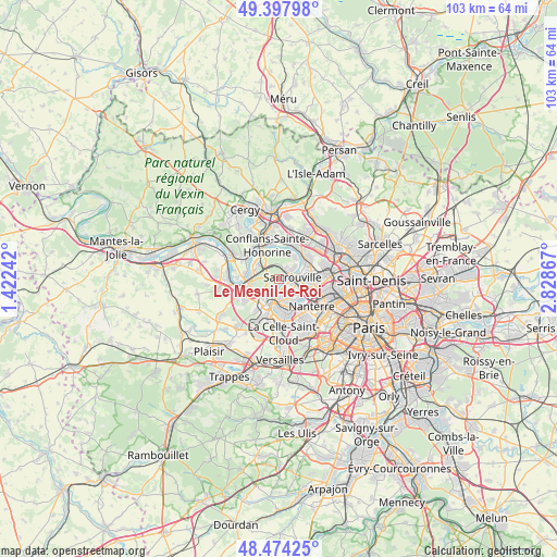
Le Mesnil-le-Roi GPS coordinates[2]
48° 56' 17.7" North, 2° 7' 31.944" East
| Map corner | latitude | longitude |
|---|---|---|
| Upper-left | 49.39798°, | 1.42242° |
| Center: | 48.93825°, | 2.12554° |
| Lower-right: | 48.47425°, | 2.82867° |
| Map W x H: | 102.7×102.7 km | = 63.8×63.8mi |
| max Lat: | 51.07786° ⇑21.7% North |
| Le Mesnil-le-Roi: | 48.93825° |
| min Lat: | ⇓78.3% South 41.3874° |
| min Long | Le Mesnil-le-Ro | max Long |
| -5.08615° | 2.12554° | 9.52242° |
| W 44.5%⇐ | ⇒55.5% E |
Elevation
Elevation of Le Mesnil-le-Roi is 60 m = 197 ft, and this is 133.7 m = 439 ft below average elevation for this country.
| Max E: |
2333 m = 7654 ft | 77.8% |
| Avg. | 193.7 m = 635 ft | |
| Le Mesnil-le-Roi | 60 m = 197 ft | |
Min E: |
-1 m = -3 ft | 22.2% |
See also: France elevation on elevation.city.
Geographical zone
Le Mesnil-le-Roi is located in North temperate zone (between Tropic of Cancer and the Arctic Circle). Distance of this North polar circle is 1959.8 km =1217.8 mi to North.| Distance of | km | miles | from Le Mesnil-le-Roi |
|---|---|---|---|
| North Pole | 4565.6 | 2836.9 | to North |
| Arctic Circle | 1959.8 | 1217.8 | to North |
| Tropic Cancer | 2835.5 | 1761.9 | to South |
| Equator | 5441.4 | 3381.1 | to South |


Nearby cities:
15 places around Le Mesnil-le-Roi: (largest is in red/bold)
• Achères
4.9 km =3 mi,  301°
301°
• Carrières-sous-Poissy
6.3 km =3.9 mi,  281°
281°
• Carrières-sur-Seine
5.2 km =3.2 mi,  131°
131°
• Chatou
5.9 km =3.7 mi,  155°
155°
• Herblay
6.6 km =4.1 mi,  29°
29°
• Houilles
5.2 km =3.2 mi,  110°
110°
• La Frette-sur-Seine
6.1 km =3.8 mi,  39°
39°
• Le Pecq
5.3 km =3.3 mi,  197°
197°
• Le Port-Marly
5.4 km =3.4 mi,  190°
190°
• Le Vésinet
5.1 km =3.2 mi,  173°
173°
• Maisons-Laffitte
2.2 km =1.4 mi, 41°
• Montesson
3.3 km =2.1 mi, 164°
• Poissy
5.6 km =3.5 mi,  259°
259°
• Saint-Germain-en-Laye
5.3 km =3.3 mi,  208°
208°
• Sartrouville
5 km =3.1 mi,  77°
77°
Sources, notices
• [Note1] Compared only with cities in France existing in our database
• [Src1] Map data: © OpenStreetMap contributors (CC-BY-SA)
• [Src2] Other city data from geonames.org with taken over terms of usage.
• [Src3] Geographical zone / Annual Mean Temperature by Robert A. Rohde @ Wikipedia
