Le Grand-Bourg geodata
Le Grand-Bourg (Nouvelle-Aquitaine) is a populated place; located in France in Europe/Paris (GMT+2) time zone. With population of 1,312 people, there are 6966 cities with bigger population in this country. Compared to other cities in France, 64.1% of cities are located further ↑North; 61.1% of cities are located further →East and 88.1% of cities have lower elevation than Le Grand-Bourg. Note1
Administrative division(s):
- Level 1: Nouvelle-Aquitaine
- Level 2: Creuse
- Level 3: Arrondissement de Guéret
- Level 4: Le Grand-Bourg


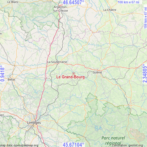
Le Grand-Bourg GPS coordinates[2]
46° 9' 36.756" North, 1° 38' 41.748" East
| Map corner | latitude | longitude |
|---|---|---|
| Upper-left | 46.64507°, | 0.9418° |
| Center: | 46.16021°, | 1.64493° |
| Lower-right: | 45.67104°, | 2.34805° |
| Map W x H: | 108.3×108.3 km | = 67.3×67.3mi |
| max Lat: | 51.07786° ⇑64.1% North |
| Le Grand-Bourg: | 46.16021° |
| min Lat: | ⇓35.9% South 41.3874° |
| min Long | Le Grand-Bourg | max Long |
| -5.08615° | 1.64493° | 9.52242° |
| W 38.9%⇐ | ⇒61.1% E |
Elevation
Elevation of Le Grand-Bourg is 390 m = 1280 ft, and this is 196.3 m = 644 ft above average elevation for this country.
| Max E: |
2333 m = 7654 ft | 11.9% |
| Le Grand-Bourg | 390 m 1280 ft | |
| Avg. | 193.7 m = 635 ft | |
Min E: |
-1 m = -3 ft | 88.1% |
See also: France elevation on elevation.city.
Geographical zone
Le Grand-Bourg is located in North temperate zone (between Tropic of Cancer and the Arctic Circle). Distance of this North polar circle is 2268.6 km =1409.6 mi to North.| Distance of | km | miles | from Le Grand-Bourg |
|---|---|---|---|
| North Pole | 4874.5 | 3028.9 | to North |
| Arctic Circle | 2268.6 | 1409.6 | to North |
| Tropic Cancer | 2526.6 | 1570 | to South |
| Equator | 5132.5 | 3189.2 | to South |


Nearby cities:
15 places around Le Grand-Bourg: (largest is in red/bold)
• Bussière-Dunoise
14.2 km =8.8 mi,  39°
39°
• Bénévent-l’Abbaye
4.9 km =3 mi,  195°
195°
• Dun-le-Palestel
16.3 km =10.1 mi,  5°
5°
• Folles
15.1 km =9.4 mi,  250°
250°
• La Souterraine
15 km =9.3 mi,  305°
305°
• Laurière
16.1 km =10 mi,  234°
234°
• Marsac
8.2 km =5.1 mi,  212°
212°
• Mourioux-Vieilleville
8.6 km =5.3 mi,  177°
177°
• Naillat
11.6 km =7.2 mi,  357°
357°
• Saint-Dizier-Leyrenne
15.4 km =9.6 mi,  160°
160°
• Saint-Pierre-de-Fursac
10.3 km =6.4 mi,  261°
261°
• Saint-Priest-la-Feuille
9.6 km =6 mi,  298°
298°
• Saint-Sulpice-le-Guérétois
14.8 km =9.2 mi,  72°
72°
• Saint-Vaury
9.8 km =6.1 mi,  60°
60°
• Saint-Étienne-de-Fursac
10.3 km =6.4 mi, 260°
Sources, notices
• [Note1] Compared only with cities in France existing in our database
• [Src1] Map data: © OpenStreetMap contributors (CC-BY-SA)
• [Src2] Other city data from geonames.org with taken over terms of usage.
• [Src3] Geographical zone / Annual Mean Temperature by Robert A. Rohde @ Wikipedia
