Saint-Vaury geodata
Saint-Vaury (Nouvelle-Aquitaine) is a populated place; located in France in Europe/Paris (GMT+2) time zone. With population of 2,016 people, there are 4757 cities with bigger population in this country. Compared to other cities in France, 63.5% of cities are located further ↑North; 59.9% of cities are located further →East and 91.3% of cities have lower elevation than Saint-Vaury. Note1
Administrative division(s):
- Level 1: Nouvelle-Aquitaine
- Level 2: Creuse
- Level 3: Arrondissement de Guéret
- Level 4: Saint-Vaury


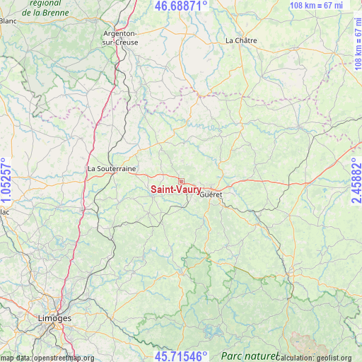
Saint-Vaury GPS coordinates[2]
46° 12' 15.264" North, 1° 45' 20.52" East
| Map corner | latitude | longitude |
|---|---|---|
| Upper-left | 46.68871°, | 1.05257° |
| Center: | 46.20424°, | 1.7557° |
| Lower-right: | 45.71546°, | 2.45882° |
| Map W x H: | 108.2×108.2 km | = 67.2×67.2mi |
| max Lat: | 51.07786° ⇑63.5% North |
| Saint-Vaury: | 46.20424° |
| min Lat: | ⇓36.5% South 41.3874° |
| min Long | Saint-Vaury | max Long |
| -5.08615° | 1.7557° | 9.52242° |
| W 40.1%⇐ | ⇒59.9% E |
Elevation
Elevation of Saint-Vaury is 457 m = 1499 ft, and this is 263.3 m = 864 ft above average elevation for this country.
| Max E: |
2333 m = 7654 ft | 8.7% |
| Saint-Vaury | 457 m 1499 ft | |
| Avg. | 193.7 m = 635 ft | |
Min E: |
-1 m = -3 ft | 91.3% |
See also: France elevation on elevation.city.
Geographical zone
Saint-Vaury is located in North temperate zone (between Tropic of Cancer and the Arctic Circle). Distance of this North polar circle is 2263.7 km =1406.6 mi to North.| Distance of | km | miles | from Saint-Vaury |
|---|---|---|---|
| North Pole | 4869.6 | 3025.8 | to North |
| Arctic Circle | 2263.7 | 1406.6 | to North |
| Tropic Cancer | 2531.5 | 1573 | to South |
| Equator | 5137.4 | 3192.2 | to South |


Nearby cities:
15 places around Saint-Vaury: (largest is in red/bold)
• Anzême
10.8 km =6.7 mi,  50°
50°
• Bussière-Dunoise
6 km =3.7 mi,  4°
4°
• Bénévent-l’Abbaye
13.8 km =8.6 mi,  225°
225°
• Dun-le-Palestel
13.3 km =8.3 mi,  328°
328°
• Glénic
13 km =8.1 mi,  80°
80°
• Guéret
9.6 km =6 mi,  111°
111°
• La Celle-Dunoise
11.7 km =7.3 mi,  5°
5°
• La Saunière
16.2 km =10.1 mi,  120°
120°
• Le Grand-Bourg
9.8 km =6.1 mi,  240°
240°
• Mourioux-Vieilleville
15.7 km =9.8 mi,  211°
211°
• Naillat
11.3 km =7 mi,  306°
306°
• Saint-Fiel
10.7 km =6.6 mi, 84°
• Saint-Sulpice-le-Dunois
10.8 km =6.7 mi,  349°
349°
• Saint-Sulpice-le-Guérétois
5.6 km =3.5 mi,  94°
94°
• Sainte-Feyre
14.3 km =8.9 mi, 120°
Sources, notices
• [Note1] Compared only with cities in France existing in our database
• [Src1] Map data: © OpenStreetMap contributors (CC-BY-SA)
• [Src2] Other city data from geonames.org with taken over terms of usage.
• [Src3] Geographical zone / Annual Mean Temperature by Robert A. Rohde @ Wikipedia
