Huelgoat geodata
Huelgoat (Brittany) is a populated place; located in France in Europe/Paris (GMT+2) time zone. With population of 1,759 people, there are 5383 cities with bigger population in this country. Compared to other cities in France, 65.7% of cities are located further ↓South; 98.7% of cities are located further →East and 65% of cities have lower elevation than Huelgoat. Note1
Administrative division(s):
- Level 1: Brittany
- Level 2: Département du Finistère
- Level 3: Arrondissement de Châteaulin
- Level 4: Huelgoat


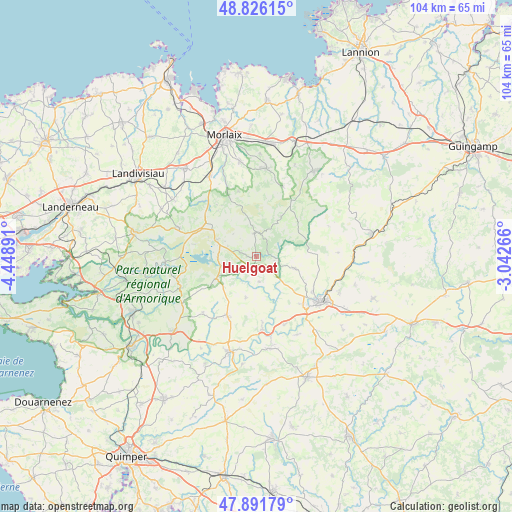
Huelgoat GPS coordinates[2]
48° 21' 39.996" North, 3° 44' 44.808" West
| Map corner | latitude | longitude |
|---|---|---|
| Upper-left | 48.82615°, | -4.44891° |
| Center: | 48.36111°, | -3.74578° |
| Lower-right: | 47.89179°, | -3.04266° |
| Map W x H: | 103.9×103.9 km | = 64.6×64.6mi |
| max Lat: | 51.07786° ⇑34.3% North |
| Huelgoat: | 48.36111° |
| min Lat: | ⇓65.7% South 41.3874° |
| min Long | Huelgoat | max Long |
| -5.08615° | -3.74578° | 9.52242° |
| W 1.3%⇐ | ⇒98.7% E |
Elevation
Elevation of Huelgoat is 194 m = 636 ft, and this is 0.30000000000001 m = 1 ft above average elevation for this country.
| Max E: |
2333 m = 7654 ft | 35% |
| Huelgoat | 194 m 636 ft | |
| Avg. | 193.7 m = 635 ft | |
Min E: |
-1 m = -3 ft | 65% |
See also: France elevation on elevation.city.
Geographical zone
Huelgoat is located in North temperate zone (between Tropic of Cancer and the Arctic Circle). Distance of this North polar circle is 2023.9 km =1257.6 mi to North.| Distance of | km | miles | from Huelgoat |
|---|---|---|---|
| North Pole | 4629.8 | 2876.8 | to North |
| Arctic Circle | 2023.9 | 1257.6 | to North |
| Tropic Cancer | 2771.3 | 1722 | to South |
| Equator | 5377.3 | 3341.3 | to South |


Nearby cities:
15 places around Huelgoat: (largest is in red/bold)
• Berrien
4.7 km =2.9 mi,  353°
353°
• Carhaix-Plouguer
15.9 km =9.9 mi,  126°
126°
• Cléden-Poher
15 km =9.3 mi,  157°
157°
• Collorec
8.7 km =5.4 mi,  193°
193°
• Kergloff
13.3 km =8.3 mi,  136°
136°
• La Feuillée
8.8 km =5.5 mi,  292°
292°
• Landeleau
14.9 km =9.3 mi,  175°
175°
• Le Cloître-Pleyben
15.7 km =9.8 mi,  222°
222°
• Le Cloître-Saint-Thégonnec
13.6 km =8.5 mi,  344°
344°
• Plonévez-du-Faou
13.9 km =8.6 mi,  207°
207°
• Plounéour-Ménez
14.2 km =8.8 mi,  314°
314°
• Plounévézel
12.7 km =7.9 mi,  122°
122°
• Plouyé
5 km =3.1 mi,  169°
169°
• Poullaouen
7.7 km =4.8 mi,  113°
113°
• Scrignac
9.5 km =5.9 mi,  31°
31°
Sources, notices
• [Note1] Compared only with cities in France existing in our database
• [Src1] Map data: © OpenStreetMap contributors (CC-BY-SA)
• [Src2] Other city data from geonames.org with taken over terms of usage.
• [Src3] Geographical zone / Annual Mean Temperature by Robert A. Rohde @ Wikipedia
