Berrien geodata
Berrien (Brittany) is a populated place; located in France in Europe/Paris (GMT+2) time zone. With population of 1,012 people, there are 8758 cities with bigger population in this country. Compared to other cities in France, 66.4% of cities are located further ↓South; 98.7% of cities are located further →East and 76.7% of cities have lower elevation than Berrien. Note1
Administrative division(s):
- Level 1: Brittany
- Level 2: Département du Finistère
- Level 3: Arrondissement de Châteaulin
- Level 4: Berrien


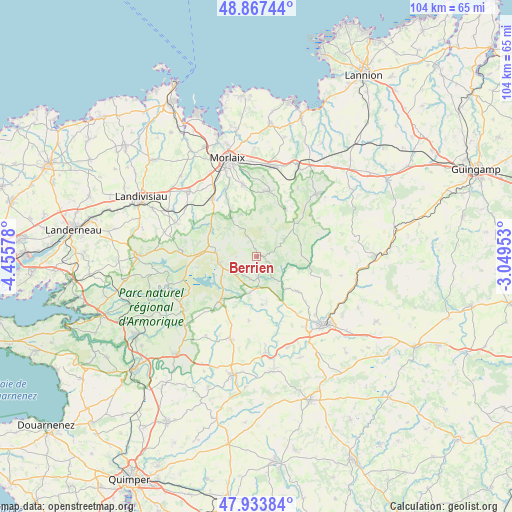
Berrien GPS coordinates[2]
48° 24' 10.008" North, 3° 45' 9.576" West
| Map corner | latitude | longitude |
|---|---|---|
| Upper-left | 48.86744°, | -4.45578° |
| Center: | 48.40278°, | -3.75266° |
| Lower-right: | 47.93384°, | -3.04953° |
| Map W x H: | 103.8×103.8 km | = 64.5×64.5mi |
| max Lat: | 51.07786° ⇑33.6% North |
| Berrien: | 48.40278° |
| min Lat: | ⇓66.4% South 41.3874° |
| min Long | Berrien | max Long |
| -5.08615° | -3.75266° | 9.52242° |
| W 1.3%⇐ | ⇒98.7% E |
Elevation
Elevation of Berrien is 261 m = 856 ft, and this is 67.3 m = 221 ft above average elevation for this country.
| Max E: |
2333 m = 7654 ft | 23.3% |
| Berrien | 261 m 856 ft | |
| Avg. | 193.7 m = 635 ft | |
Min E: |
-1 m = -3 ft | 76.7% |
See also: France elevation on elevation.city.
Geographical zone
Berrien is located in North temperate zone (between Tropic of Cancer and the Arctic Circle). Distance of this North polar circle is 2019.3 km =1254.7 mi to North.| Distance of | km | miles | from Berrien |
|---|---|---|---|
| North Pole | 4625.2 | 2874 | to North |
| Arctic Circle | 2019.3 | 1254.7 | to North |
| Tropic Cancer | 2776 | 1724.9 | to South |
| Equator | 5381.9 | 3344.2 | to South |


Nearby cities:
15 places around Berrien: (largest is in red/bold)
• Botsorhel
16.2 km =10.1 mi,  30°
30°
• Collorec
13.2 km =8.2 mi,  186°
186°
• Commana
15 km =9.3 mi,  274°
274°
• Huelgoat
4.7 km =2.9 mi,  173°
173°
• Kergloff
17.3 km =10.7 mi,  145°
145°
• La Feuillée
7.7 km =4.8 mi,  260°
260°
• Le Cloître-Saint-Thégonnec
9.1 km =5.7 mi,  340°
340°
• Pleyber-Christ
13.7 km =8.5 mi,  322°
322°
• Plougonven
12.9 km =8 mi,  11°
11°
• Plounéour-Ménez
11 km =6.8 mi,  298°
298°
• Plounévézel
16.1 km =10 mi,  135°
135°
• Plourin-lès-Morlaix
14.7 km =9.1 mi,  351°
351°
• Plouyé
9.7 km =6 mi, 171°
• Poullaouen
10.8 km =6.7 mi, 135°
• Scrignac
6.5 km =4 mi,  57°
57°
Sources, notices
• [Note1] Compared only with cities in France existing in our database
• [Src1] Map data: © OpenStreetMap contributors (CC-BY-SA)
• [Src2] Other city data from geonames.org with taken over terms of usage.
• [Src3] Geographical zone / Annual Mean Temperature by Robert A. Rohde @ Wikipedia
