Le Bourgneuf-la-Forêt geodata
Le Bourgneuf-la-Forêt (Pays de la Loire) is a populated place; located in France in Europe/Paris (GMT+2) time zone. With population of 1,650 people, there are 5666 cities with bigger population in this country. Compared to other cities in France, 62.2% of cities are located further ↓South; 87.9% of cities are located further →East and 55.6% of cities have lower elevation than Le Bourgneuf-la-Forêt. Note1
Administrative division(s):
- Level 1: Pays de la Loire
- Level 2: Mayenne
- Level 3: Arrondissement de Laval
- Level 4: Le Bourgneuf-la-Forêt


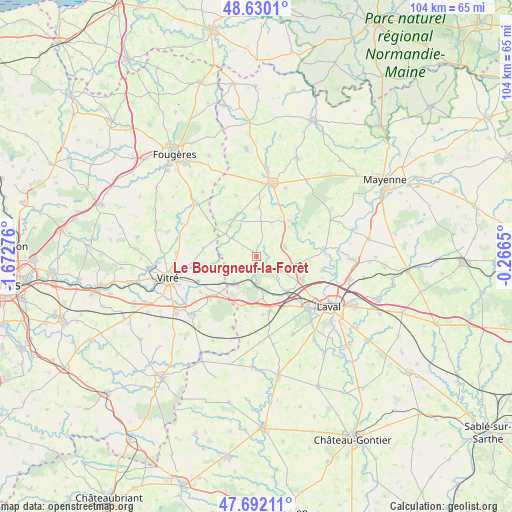
Le Bourgneuf-la-Forêt GPS coordinates[2]
48° 9' 47.7" North, 0° 58' 10.668" West
| Map corner | latitude | longitude |
|---|---|---|
| Upper-left | 48.6301°, | -1.67276° |
| Center: | 48.16325°, | -0.96963° |
| Lower-right: | 47.69211°, | -0.2665° |
| Map W x H: | 104.3×104.3 km | = 64.8×64.8mi |
| max Lat: | 51.07786° ⇑37.8% North |
| Le Bourgneuf-la-Forêt: | 48.16325° |
| min Lat: | ⇓62.2% South 41.3874° |
| min Long | Le Bourgneuf-la | max Long |
| -5.08615° | -0.96963° | 9.52242° |
| W 12.1%⇐ | ⇒87.9% E |
Elevation
Elevation of Le Bourgneuf-la-Forêt is 152 m = 499 ft, and this is 41.7 m = 137 ft below average elevation for this country.
| Max E: |
2333 m = 7654 ft | 44.4% |
| Avg. | 193.7 m = 635 ft | |
| Le Bourgneuf-la-Forêt | 152 m = 499 ft | |
Min E: |
-1 m = -3 ft | 55.6% |
See also: France elevation on elevation.city.
Geographical zone
Le Bourgneuf-la-Forêt is located in North temperate zone (between Tropic of Cancer and the Arctic Circle). Distance of this North polar circle is 2045.9 km =1271.3 mi to North.| Distance of | km | miles | from Le Bourgneuf-la-Forêt |
|---|---|---|---|
| North Pole | 4651.8 | 2890.5 | to North |
| Arctic Circle | 2045.9 | 1271.3 | to North |
| Tropic Cancer | 2749.3 | 1708.3 | to South |
| Equator | 5355.3 | 3327.6 | to South |


Nearby cities:
15 places around Le Bourgneuf-la-Forêt: (largest is in red/bold)
• Bourgon
7.2 km =4.5 mi,  273°
273°
• Bréal-sous-Vitré
9.5 km =5.9 mi,  225°
225°
• Chailland
9.9 km =6.2 mi,  45°
45°
• Juvigné
8.7 km =5.4 mi,  326°
326°
• La Baconnière
6.1 km =3.8 mi,  71°
71°
• La Brûlatte
8.7 km =5.4 mi,  172°
172°
• La Croixille
8 km =5 mi,  305°
305°
• La Gravelle
10.6 km =6.6 mi,  199°
199°
• Loiron
11.1 km =6.9 mi, 165°
• Mondevert
13.1 km =8.1 mi, 227°
• Port-Brillet
5.6 km =3.5 mi,  180°
180°
• Ruillé-le-Gravelais
11.9 km =7.4 mi, 174°
• Saint-Hilaire-du-Maine
7.6 km =4.7 mi,  22°
22°
• Saint-Ouën-des-Toits
6.1 km =3.8 mi,  122°
122°
• Saint-Pierre-la-Cour
7 km =4.3 mi,  216°
216°
Sources, notices
• [Note1] Compared only with cities in France existing in our database
• [Src1] Map data: © OpenStreetMap contributors (CC-BY-SA)
• [Src2] Other city data from geonames.org with taken over terms of usage.
• [Src3] Geographical zone / Annual Mean Temperature by Robert A. Rohde @ Wikipedia
